Police Helicopter to Ashington, A1068
Wednesday, 11 March 2026 | 1:15 | From Newcastle International Airport
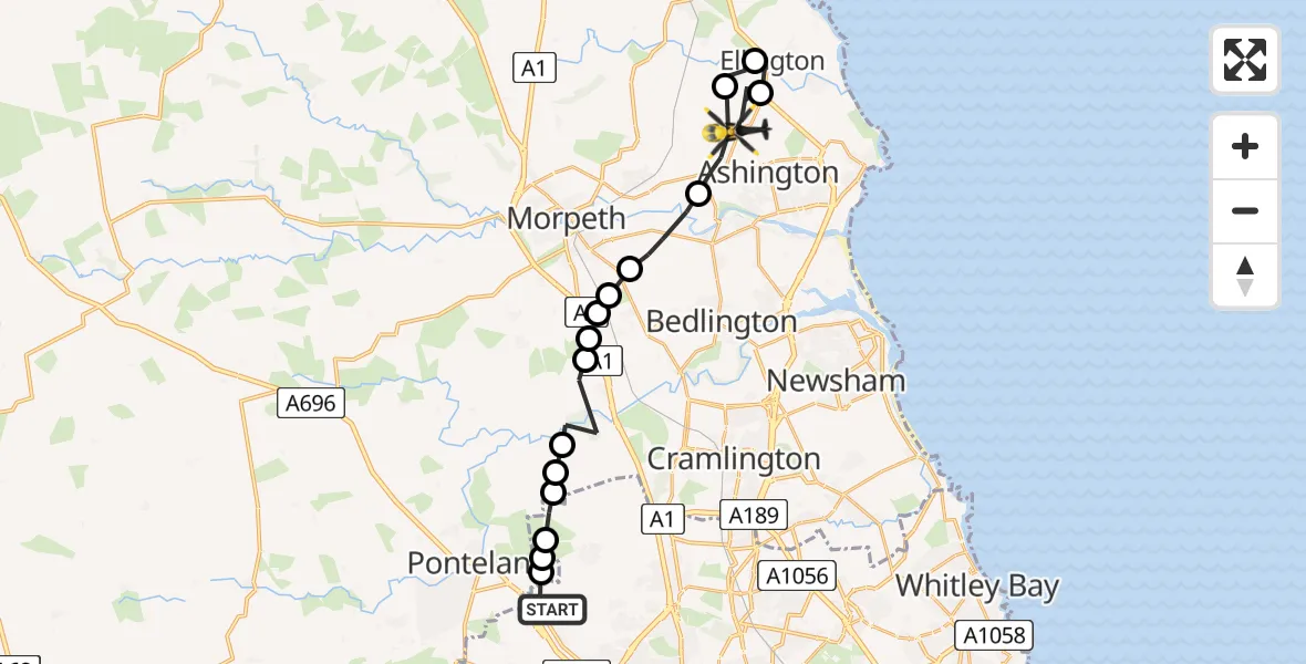
On Wednesday, 11 March 2026 at 1:15, a Police Helicopter departed from Newcastle International Airport to Ashington. It was the Police Helicopter with registration number G-POLA. The flight lasted 10 minutes. During that period, the aircraft travelled 19 miles at an average speed of 111 miles per hour at a maximum altitude of 1925 feet.
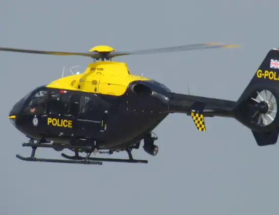
Helicopter: G-POLA
The helicopter G-POLA is used by the British police. The helicopter is deployed in pursuits, missing persons cases and other incidents where a helicopter provides added value.
Photo: ozz13x
20 miles
1925 feet
111 mph
11 minutes
01:15
01:25

Route
A1068, North East01:25
Ashington, North East01:23
Ellington, North East01:22
Linton, North East01:21
Ashington, North East01:20
Hepscott, North East01:19
Stannington Station, North East01:19
Clifton, North East01:18
Glororum, North East01:18
Clifton, North East01:18
Stannington, North East01:17
Ponteland, North East01:17
Newcastle upon Tyne, North East01:16
Dinnington, Newcastle upon Tyne01:16
Prestwick, Ponteland01:16
Dinnington, Ponteland01:15
Newcastle International Airport, Newcastle upon Tyne, Tyne and Wear01:15
Today
Flights Ashington
Police Helicopter to Ashington, A106811 Mar 01:15
Helicopter flights on your website?
You can easily display helicopter flights on your own website. Use the embed code.
