Coastguard Helicopter to St. Neot
Tuesday, 10 March 2026 | 21:31 | From Tregurrian
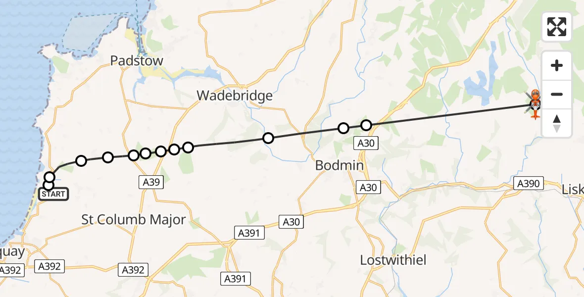
On Tuesday, 10 March 2026 at 21:31, a Coastguard Helicopter departed from Tregurrian to St. Neot. It was the Coastguard Helicopter with registration number G-MCGF. The flight lasted 8 minutes. During that period, the aircraft travelled 24 miles at an average speed of 172 miles per hour at a maximum altitude of 4175 feet.
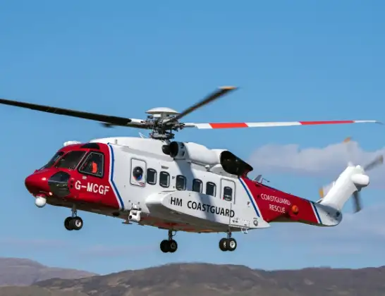
Helicopter: G-MCGF
The helicopter G-MCGF is used by the British Coastguard. The helicopter is deployed in search and rescue operations at sea, rescue operations involving ships or drilling platforms, patrols to prevent smuggling or piracy, environmental monitoring and disaster relief support.
Photo: The Carlisle Kid
24 miles
4175 feet
172 mph
9 minutes
21:31
21:39

Route
St. Neot, St. Neot21:39
St. Neot, St. Neot21:39
Bodmin, Bodmin21:37
Helland, Helland21:37
Egloshayle, Egloshayle21:36
St. Breock, St. Breock21:34
Tremayne, St. Columb Major21:34
St Issey, St Issey21:34
St. Issey, St. Issey21:34
St. Columb Major, St. Columb Major21:33
Rumford, Rumford21:33
St. Eval, St. Eval21:32
Mawgan Porth, Mawgan Porth21:32
Tregurrian, Tregurrian21:31
Tregurrian Hill, Newquay21:31
Live flights
Today
Flights Tregurrian
Police Helicopter to Cornwall Airport Newquay20 Apr 15:49
Coastguard Helicopter to St. Neot10 Mar 21:31
Police Helicopter to Tregurrian31 Jan 16:39
Coastguard Helicopter to Tregurrian, B327626 Jan 10:59
Helicopter flights on your website?
You can easily display helicopter flights on your own website. Use the embed code.
