Air Ambulance Helicopter to Churchdown, A40
Tuesday, 10 March 2026 | 14:15 | From Gloucestershire Airport
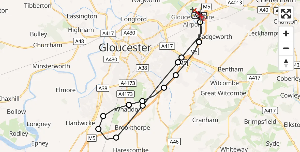
On Tuesday, 10 March 2026 at 14:15, a Air Ambulance Helicopter departed from Gloucestershire Airport to Churchdown. It was the Air Ambulance Helicopter with registration number G-WYDN. The flight lasted 17 minutes. During that period, the aircraft travelled 17 miles at an average speed of 63 miles per hour at a maximum altitude of 1250 feet.

Helicopter: G-WYDN
The helicopter G-WYDN is used as a air ambulance helicopter. The main purpose of this aircraft is to transport a Mobile Medical Team to an incident as quickly as possible, enabling the trauma doctor to provide immediate first aid on site. The aircraft is flying this flight as Air Ambulance Helicopter.
Photo: Tony Melony
18 miles
1250 feet
63 mph
17 minutes
14:15
14:31

Route
A40, Tewkesbury14:31
Gloucestershire Airport, Staverton14:30
Churchdown, Tewkesbury14:29
Tewkesbury, Tewkesbury14:28
Stroud, Stroud14:28
Gloucester, Gloucester14:27
Whaddon, Stroud14:27
Gloucester, Gloucester14:27
Hardwicke, Stroud14:26
Haresfield, Stroud14:26
Brookthorpe, Stroud14:25
Gloucester, Gloucester14:23
Tewkesbury, Tewkesbury14:23
Churchdown, Tewkesbury14:21
Gloucestershire Airport, Staverton14:18
A40, Tewkesbury14:16
A40, Tewkesbury14:16
A40, Tewkesbury14:15
A40, Tewkesbury14:15
Today
Flights Churchdown
Air Ambulance Helicopter to Churchdown, A4011 Mar 12:56
Air Ambulance Helicopter to Churchdown, A4011 Mar 10:47
Air Ambulance Helicopter to Churchdown, A4011 Mar 09:17
Air Ambulance Helicopter to Churchdown, A4011 Mar 09:11
Air Ambulance Helicopter to Churchdown, A4010 Mar 15:53
Air Ambulance Helicopter to Churchdown, A4010 Mar 14:15
Air Ambulance Helicopter to Churchdown, A4010 Mar 12:13
Air Ambulance Helicopter to Churchdown, A4010 Mar 10:43
Air Ambulance Helicopter to Churchdown, A4010 Mar 10:37
Air Ambulance Helicopter to Churchdown, A409 Mar 17:20
Helicopter flights on your website?
You can easily display helicopter flights on your own website. Use the embed code.
