Police Helicopter to MOD St Athan
Monday, 9 March 2026 | 18:04 | From Troed-y-rhiw
On Monday, 9 March 2026 at 18:04, a Police Helicopter departed from Troed-y-rhiw to MOD St Athan. It was the Police Helicopter with registration number G-NWOI. The flight lasted 21 minutes. During that period, the aircraft travelled 315 miles at an average speed of 893 miles per hour at a maximum altitude of 1800 feet.
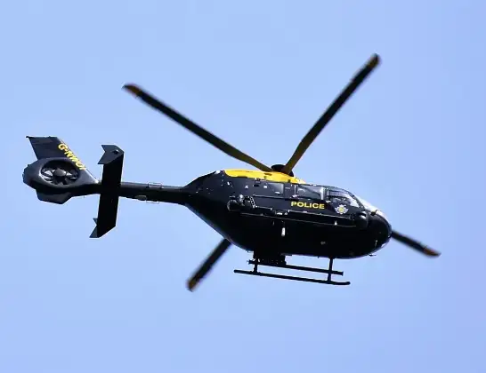
Helicopter: G-NWOI
The helicopter G-NWOI is used by the British police. The helicopter is deployed in pursuits, missing persons cases and other incidents where a helicopter provides added value.
Photo: Alec Wilson
315 miles
1800 feet
893 mph
22 minutes
18:04
18:25

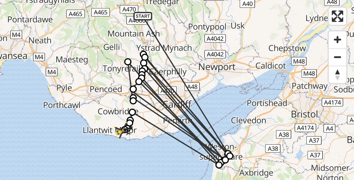
Route
MOD St Athan, St Athan, Vale of Glamorgan18:25
MOD St Athan, St Athan, Vale of Glamorgan18:25
Flemingston, Flemingston18:25
Llancarfan, Llancarfan18:24
Bonvilston, Bonvilston18:24
Llancarfan, Llancarfan18:23
Bleadon, Bleadon18:23
Porth, Porth18:23
Pendoylan, Pendoylan18:22
Miskin, Miskin18:22
Weston-super-Mare, Weston-super-Mare18:22
Miskin, Miskin18:21
Llantrisant, Llantrisant18:20
Uphill, Weston-super-Mare18:20
Llantwit Fardre, Llantwit Fardre18:20
Rhydyfelin, Rhydyfelin18:19
Hawthorn, Hawthorn18:19
Hawthorn, Pontypridd18:19
Uphill, Weston-super-Mare18:19
Y Graig, Pontypridd18:18
Weston-super-Mare, Weston-super-Mare18:18
Cilfynydd, Pontypridd18:18
Glyncoch, Pontypridd18:18
Weston-super-Mare, Weston-super-Mare18:13
Troed-y-rhiw, Troed-y-rhiw18:04
Live flights
Today
Flights Troed-y-rhiw
Police Helicopter to MOD St Athan9 Mar 18:04
Helicopter flights on your website?
You can easily display helicopter flights on your own website. Use the embed code.
