Police Helicopter to Benson, The Sands
Monday, 9 March 2026 | 17:48 | From Standlake
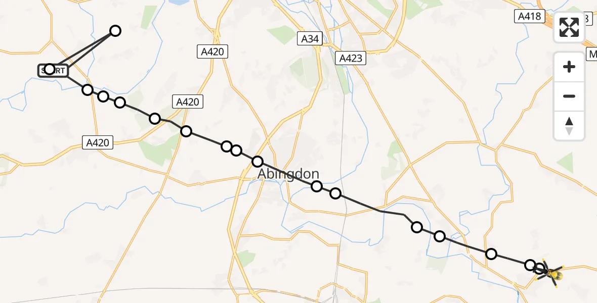
On Monday, 9 March 2026 at 17:48, a Police Helicopter departed from Standlake to Benson. It was the Police Helicopter with registration number G-POLF. The flight lasted 10 minutes. During that period, the aircraft travelled 22 miles at an average speed of 139 miles per hour at a maximum altitude of 1100 feet.
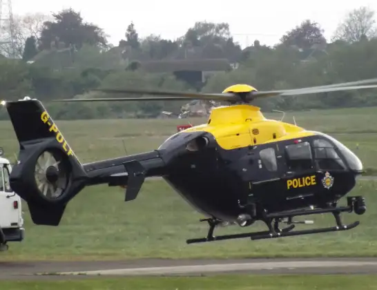
Helicopter: G-POLF
The helicopter G-POLF is used by the British police. The helicopter is deployed in pursuits, missing persons cases and other incidents where a helicopter provides added value.
Photo: James
23 miles
1100 feet
139 mph
10 minutes
17:48
17:57

Route
The Sands, South Oxfordshire17:57
Berrick Salome, South Oxfordshire17:57
Benson, South Oxfordshire17:57
Warborough, South Oxfordshire17:56
Dorchester-on-Thames, South Oxfordshire17:56
Long Wittenham, South Oxfordshire17:55
Clifton Hampden, South Oxfordshire17:54
Radley, Abingdon17:54
Abingdon, Vale of White Horse17:53
Shippon, Vale of White Horse17:53
Cothill, Vale of White Horse17:53
Marcham, Vale of White Horse17:52
Tubney, Vale of White Horse17:52
Fyfield, Vale of White Horse17:51
Northmoor, West Oxfordshire17:51
Longworth, Vale of White Horse17:51
Standlake, West Oxfordshire17:50
Stanton Harcourt, West Oxfordshire17:50
Crift Lane, West Oxfordshire17:48
Live flights
Flights Benson
Police Helicopter to Benson, Clack's Lane2 Jul 19:06
Police Helicopter to Benson, A41301 Jul 15:27
Police Helicopter to Benson, Braze Lane1 Jul 13:48
Police Helicopter to RAF Benson30 Jun 19:42
Police Helicopter to Benson, The Sands30 Jun 15:07
Police Helicopter to Benson, The Sands28 Jun 21:41
Police Helicopter to Benson, Clack's Lane28 Jun 17:16
Police Helicopter to RAF Benson27 Jun 19:48
Police Helicopter to Berrick Salome, Benson27 Jun 17:58
Police Helicopter to Benson, The Sands27 Jun 13:43
Flights Standlake
Police Helicopter to Buckland, Tenfoot Bridge30 May 19:08
Police Helicopter to Benson, The Sands9 Mar 17:48
Police Helicopter to Standlake, Crift Lane9 Mar 17:44
Helicopter flights on your website?
You can easily display helicopter flights on your own website. Use the embed code.
