Coastguard Helicopter to Inverness Airport
Saturday, 7 March 2026 | 14:39 | From Roughburn
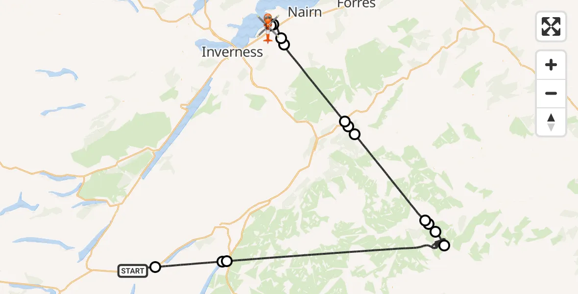
On Saturday, 7 March 2026 at 14:39, a Coastguard Helicopter departed from Roughburn to Inverness Airport. It was the Coastguard Helicopter with registration number G-MCGT. The flight lasted 65 minutes. During that period, the aircraft travelled 123 miles at an average speed of 115 miles per hour at a maximum altitude of 5325 feet.
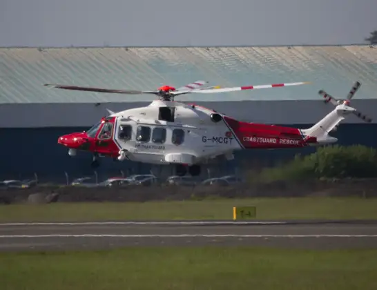
Helicopter: G-MCGT
The helicopter G-MCGT is used by the British Coastguard. The helicopter is deployed in search and rescue operations at sea, rescue operations involving ships or drilling platforms, patrols to prevent smuggling or piracy, environmental monitoring and disaster relief support.
Photo: Ronnie Macdonald
124 miles
5325 feet
115 mph
65 minutes
14:39
15:44

Route
Inverness Airport, Inverness15:44
Inverness Airport, Inverness15:43
Inverness Airport, Inverness15:42
Ardersier, Ardersier15:41
Croy, Croy15:40
Cantray, Cantray15:39
Dulnain Bridge, Dulnain Bridge15:32
Grantown-on-Spey, Grantown-on-Spey15:32
Nethy Bridge, Nethy Bridge15:31
Inver, Inver15:23
Balnault, Balnault15:22
Crathie, Crathie15:21
Spittal of Glenmuick, Spittal of Glenmuick15:19
Dalwhinnie, Dalwhinnie14:45
Loch Ericht14:45
Laggan Reservoir14:41
A86, Roughburn14:39
Live flights
Police Helicopter on its way from Ewelme13 Jul 22:24
Today
Police Helicopter to Manchester Barton Aerodrome13 Jul 23:56
Police Helicopter to Bournemouth Airport13 Jul 23:55
Air Ambulance Helicopter to Cardiff Heliport13 Jul 23:38
Police Helicopter to Birmingham Airport13 Jul 23:21
Police Helicopter to Irlam, Twelve Yards Road13 Jul 23:00
Flights Roughburn
Coastguard Helicopter to Inverness Airport7 Mar 14:39
Helicopter flights on your website?
You can easily display helicopter flights on your own website. Use the embed code.
