Coastguard Helicopter to Inverroy
Friday, 6 March 2026 | 19:56 | From Inverness Airport
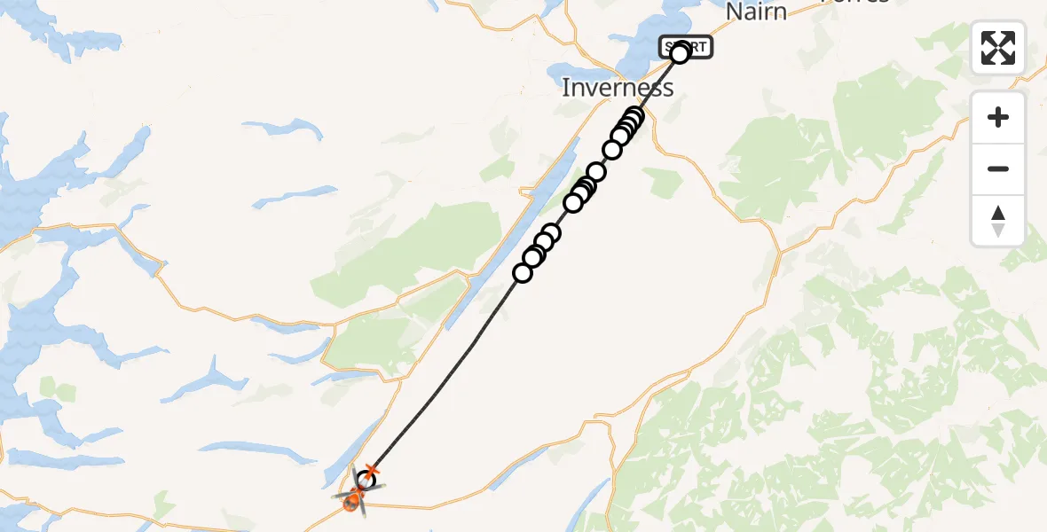
On Friday, 6 March 2026 at 19:56, a Coastguard Helicopter departed from Inverness Airport to Inverroy. It was the Coastguard Helicopter with registration number G-MCGT. The flight lasted 25 minutes. During that period, the aircraft travelled 53 miles at an average speed of 126 miles per hour at a maximum altitude of 4175 feet.

Helicopter: G-MCGT
The helicopter G-MCGT is used by the British Coastguard. The helicopter is deployed in search and rescue operations at sea, rescue operations involving ships or drilling platforms, patrols to prevent smuggling or piracy, environmental monitoring and disaster relief support.
Photo: Ronnie Macdonald
54 miles
4175 feet
126 mph
26 minutes
19:56
20:21

Route
Inverroy, Inverroy20:21
Inverroy, Inverroy20:21
Dalcrag, Dalcrag20:10
Loch Mhòr20:09
Lochgarthside, Lochgarthside20:09
Gorthleck, Gorthleck20:08
Errogie, Errogie20:07
Torness, Torness20:06
Dail Crombaidh, Dail Crombaidh20:05
Loch Duntelchaig20:05
Dail Crombaidh, Dail Crombaidh20:05
Loch Duntelchaig20:04
Bunachton, Bunachton20:03
Inverness, Inverness20:02
Inverarnie, Inverarnie20:02
Slackbuie, Slackbuie20:01
Inverness, Inverness20:01
Inshes and Milton of Leys, Inshes and Milton of Leys20:01
Inverness, Inverness19:57
A96, Tornagrain19:57
Inverness Airport, Inverness19:56
Today
Flights Inverroy
Coastguard Helicopter to Inverroy6 Mar 19:56
Helicopter flights on your website?
You can easily display helicopter flights on your own website. Use the embed code.
