Police Helicopter to Forrestfield
Friday, 6 March 2026 | 19:42 | From Glasgow
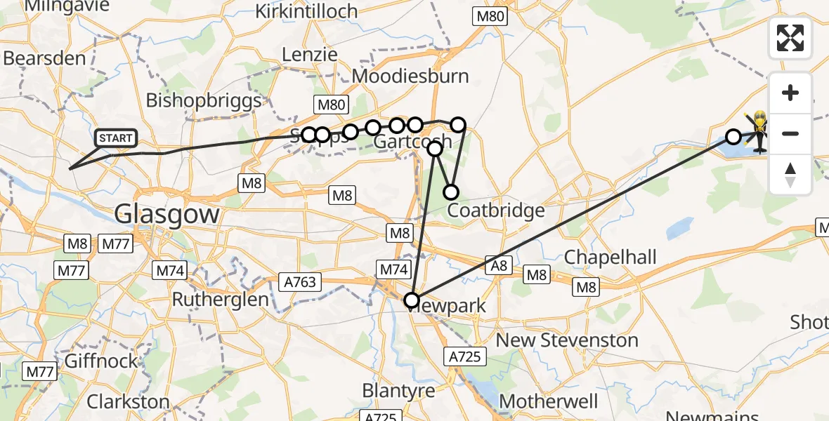
On Friday, 6 March 2026 at 19:42, a Police Helicopter departed from Glasgow to Forrestfield. It was the Police Helicopter with registration number G-PSHU. The flight lasted 8 minutes. During that period, the aircraft travelled 29 miles at an average speed of 230 miles per hour at a maximum altitude of 1475 feet.
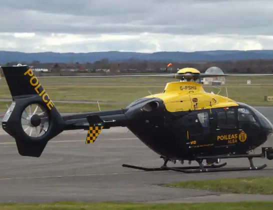
Helicopter: G-PSHU
The helicopter G-PSHU is used by the British police. The helicopter is deployed in pursuits, missing persons cases and other incidents where a helicopter provides added value.
Photo: James from Cheltenham, Gloucestershire
30 miles
1475 feet
230 mph
8 minutes
19:42
19:50

Route
Forrestfield, Forrestfield19:50
Hillend Loch19:50
Viewpark, Viewpark19:49
Gartcosh, Gartcosh19:48
Coatbridge, Coatbridge19:48
Glenboig, Glenboig19:47
Gartcosh, Gartcosh19:47
Mount Ellen, Mount Ellen19:47
Muirhead, Muirhead19:46
Stepps, Stepps19:46
Glasgow, Glasgow19:46
Stepps, Stepps19:46
Forth and Clyde Canal Glasgow Spur Towpath, Glasgow19:42
Live flights
Today
Flights Forrestfield
Police Helicopter to Forrestfield6 Mar 19:42
Flights Glasgow
Police Helicopter to Dumbarton, Greenhead Road13 Jul 13:23
Police Helicopter to Johnstone, Elderslie12 Jul 20:54
Police Helicopter to Glasgow, Kinfauns Drive12 Jul 12:13
Police Helicopter to Glasgow, Ainslie Avenue11 Jul 15:40
Police Helicopter to Glasgow, Walkerburn Road11 Jul 15:37
Police Helicopter to Glasgow, Paisley Road West11 Jul 15:32
Police Helicopter to Glasgow, Paisley Road West11 Jul 15:13
Police Helicopter to Glasgow, Kinnell Avenue11 Jul 15:09
Helicopter flights on your website?
You can easily display helicopter flights on your own website. Use the embed code.
