Air Ambulance Helicopter to Henstridge Airfield
Thursday, 5 March 2026 | 19:50 | From Larkhill
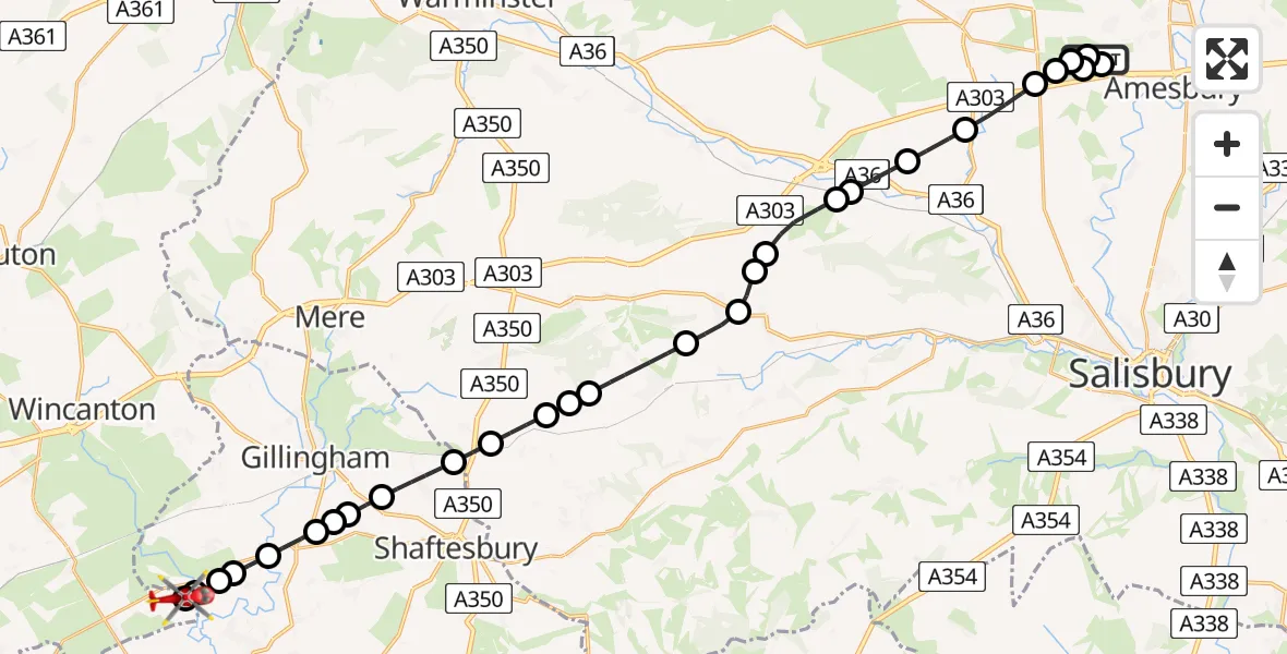
On Thursday, 5 March 2026 at 19:50, a Air Ambulance Helicopter departed from Larkhill to Henstridge Airfield. It was the Air Ambulance Helicopter with registration number G-DSAA. The flight lasted 19 minutes. During that period, the aircraft travelled 29 miles at an average speed of 93 miles per hour at a maximum altitude of 2375 feet.
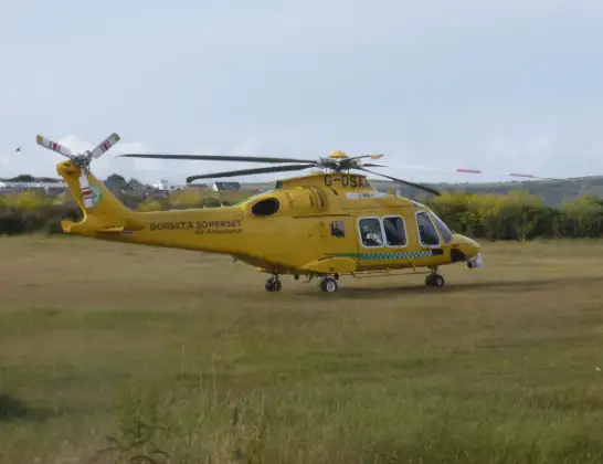
Helicopter: G-DSAA
The helicopter G-DSAA is used as a air ambulance helicopter. The main purpose of this aircraft is to transport a Mobile Medical Team to an incident as quickly as possible, enabling the trauma doctor to provide immediate first aid on site. The aircraft is flying this flight as Air Ambulance Helicopter.
Photo: Andrew Bone
30 miles
2375 feet
93 mph
20 minutes
19:50
20:09

Route
Henstridge Airfield, Templecombe, Somerset20:09
Henstridge Airfield, Templecombe, Somerset20:09
Henstridge Airfield, Templecombe, Somerset20:08
Henstridge Airfield, Templecombe, Somerset20:07
Kington Magna20:07
West Stour20:06
Fifehead Magdalen20:06
West Stour20:05
East Stour20:05
Gillingham20:04
East Stour20:04
Gillingham20:04
Motcombe20:02
Sedgehill20:02
Semley20:01
West Tisbury20:01
Fonthill Gifford20:01
Tisbury19:59
Chilmark19:59
Teffont Magna19:58
Teffont19:58
Wylye19:57
Hanging Langford19:57
Steeple Langford19:56
Berwick St James19:55
Winterbourne Stoke19:54
Wilsford cum Lake19:54
Larkhill19:54
Amesbury19:53
Larkhill19:52
Amesbury19:52
Byway 12, 19:50
Live flights
Today
Flights Larkhill
Helicopter flights on your website?
You can easily display helicopter flights on your own website. Use the embed code.
