Air Ambulance Helicopter to Thorganby CP
Thursday, 5 March 2026 | 14:49 | From Thimbleby

On Thursday, 5 March 2026 at 14:49, a Air Ambulance Helicopter departed from Thimbleby to Thorganby CP. It was the Air Ambulance Helicopter with registration number G-LNCC. The flight lasted 9 minutes. During that period, the aircraft travelled 18 miles at an average speed of 120 miles per hour at a maximum altitude of 1075 feet.
Helicopter: G-LNCC
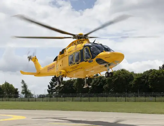
The helicopter G-LNCC is used as a air ambulance helicopter. The main purpose of this aircraft is to transport a Mobile Medical Team to an incident as quickly as possible, enabling the trauma doctor to provide immediate first aid on site. The aircraft is flying this flight as Air Ambulance Helicopter.
Photo: Lincs & Notts
19 miles
1075 feet
120 mph
10 minutes
14:49
14:58

Route
Thorganby CP, West Lindsey14:58
Thorganby CP, West Lindsey14:57
Thorganby CP, Grimsby14:57
Thorganby CP, West Lindsey14:57
Swinhope CP, West Lindsey14:56
Binbrook, East Lindsey14:56
East Lindsey, Greater Lincolnshire14:55
Burgh on Bain, East Lindsey14:54
Donington on Bain, East Lindsey14:53
East Lindsey, Greater Lincolnshire14:53
Goulceby, East Lindsey14:53
East Lindsey, Greater Lincolnshire14:52
Hemingby, East Lindsey14:51
Thimbleby, East Lindsey14:51
West Ashby, Horncastle14:51
Thimbleby, Horncastle14:50
Thimbleby Hill, East Lindsey14:50
Thimbleby, East Lindsey14:49
Live flights
Police Helicopter on its way from Ewelme13 Jul 22:24
Today
Police Helicopter to Manchester Barton Aerodrome13 Jul 23:56
Police Helicopter to Bournemouth Airport13 Jul 23:55
Air Ambulance Helicopter to Cardiff Heliport13 Jul 23:38
Police Helicopter to Birmingham Airport13 Jul 23:21
Police Helicopter to Irlam, Twelve Yards Road13 Jul 23:00
Flights Thimbleby
Air Ambulance Helicopter to Thorganby CP5 Mar 14:49
Helicopter flights on your website?
You can easily display helicopter flights on your own website. Use the embed code.
