Air Ambulance Helicopter to Teesside International Airport
Wednesday, 4 March 2026 | 7:50 | From Rokeby
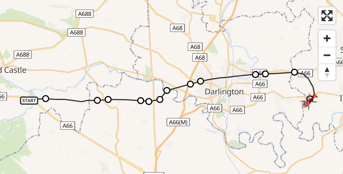
On Wednesday, 4 March 2026 at 7:50, a Air Ambulance Helicopter departed from Rokeby to Teesside International Airport. It was the Air Ambulance Helicopter with registration number G-NHAE. The flight lasted 8 minutes. During that period, the aircraft travelled 21 miles at an average speed of 147 miles per hour at a maximum altitude of 1250 feet.
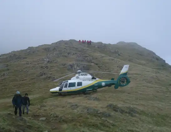
Helicopter: G-NHAE
The helicopter G-NHAE is used as a air ambulance helicopter. The main purpose of this aircraft is to transport a Mobile Medical Team to an incident as quickly as possible, enabling the trauma doctor to provide immediate first aid on site. The aircraft is flying this flight as Air Ambulance Helicopter.
Photo: Michael Earnshaw
21 miles
1250 feet
147 mph
9 minutes
07:50
07:58

Route
Teesside International Airport, Darlington, Durham07:58
Teesside International Airport, Darlington, Durham07:58
Longnewton, Tees Valley07:57
Sadberge, Tees Valley07:56
Great Burdon, Tees Valley07:55
Darlington, Tees Valley07:54
Merrybent, Tees Valley07:54
High Coniscliffe, Tees Valley07:53
Darlington, York and North Yorkshire07:53
Aldbrough St John, York and North Yorkshire07:53
Manfield, York and North Yorkshire07:52
Forcett, York and North Yorkshire07:52
Caldwell, York and North Yorkshire07:51
Wycliffe with Thorpe, North East07:50
Rokeby, North East07:50
Live flights
Today
Flights Rokeby
Helicopter flights on your website?
You can easily display helicopter flights on your own website. Use the embed code.
