Air Ambulance Helicopter to Langley Mill, Brookfield Way
Wednesday, 4 March 2026 | 11:41 | From Nottingham Heliport
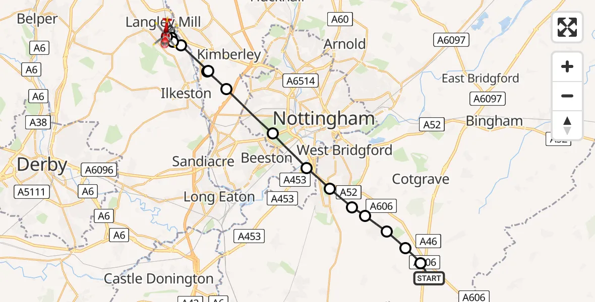
On Wednesday, 4 March 2026 at 11:41, a Air Ambulance Helicopter departed from Nottingham Heliport to Langley Mill. It was the Air Ambulance Helicopter with registration number G-DRLA. The flight lasted 8 minutes. During that period, the aircraft travelled 20 miles at an average speed of 153 miles per hour at a maximum altitude of 1350 feet.
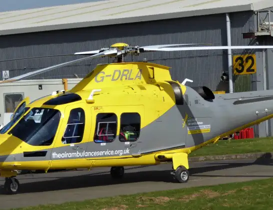
Helicopter: G-DRLA
The helicopter G-DRLA is used as an ambulance helicopter. The helicopter is equipped with a stretcher for transporting patients. The helicopter is often used to transport to hospitals.
Photo: Alec Wilson
20 miles
1350 feet
153 mph
8 minutes
11:41
11:49

Route
Brookfield Way, Amber Valley11:49
Langley Mill, Amber Valley11:48
Shipley, Langley Mill11:48
Langley Mill, Amber Valley11:47
Shipley, Langley Mill11:47
Cossall, Broxtowe11:46
Awsworth, City of Nottingham11:46
Cossall, City of Nottingham11:46
Wollaton, City of Nottingham11:45
City of Nottingham, East Midlands11:44
Ruddington, West Bridgford11:43
Ruddington, Rushcliffe11:43
Plumtree, Rushcliffe11:43
Keyworth, Rushcliffe11:42
Stanton on the Wolds, Rushcliffe11:42
Widmerpool, Rushcliffe11:41
Nottingham Heliport, 11:41
Live flights
Today
Helicopter flights on your website?
You can easily display helicopter flights on your own website. Use the embed code.
