Police Helicopter to Perth, Mercian Buildings
Monday, 2 March 2026 | 18:04 | From Abronhill
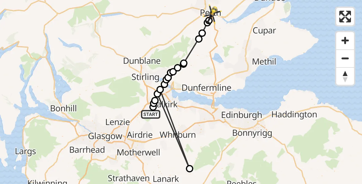
On Monday, 2 March 2026 at 18:04, a Police Helicopter departed from Abronhill to Perth. It was the Police Helicopter with registration number G-BZRS. The flight lasted 12 minutes. During that period, the aircraft travelled 84 miles at an average speed of 428 miles per hour at a maximum altitude of 2850 feet.
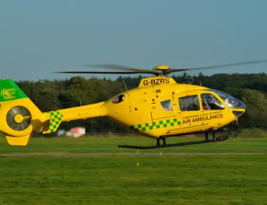
Helicopter: G-BZRS
The helicopter G-BZRS is used by the British police. The helicopter is deployed in pursuits, missing persons cases and other incidents where a helicopter provides added value.
Photo: NMOS332
84 miles
2850 feet
428 mph
12 minutes
18:04
18:16

Route
Mercian Buildings, 18:16
Perth18:15
Forgandenny18:15
Perth18:14
Dunning18:13
Dollar18:10
Pool of Muckhart18:10
Dollar18:09
Tillicoultry18:09
Coalsnaughton18:09
Clackmannan18:08
Alloa18:08
South Alloa18:07
Stirling18:07
Bertram House18:06
Stenhousemuir18:06
Larbert18:06
Bonnybridge18:05
High Bonnybridge18:05
Abronhill, 18:04
Live flights
Today
Flights Perth
Police Helicopter to Perth15 Jul 18:07
Police Helicopter to Perth and Kinross12 Jul 09:53
Police Helicopter to Perth10 Jul 18:36
Police Helicopter to Perth and Kinross, B9341 Jul 16:10
Police Helicopter to Little Powgavie, B95824 Jun 10:08
Police Helicopter to Pitcairngreen15 Jun 18:24
Police Helicopter to Perth, Dower Place5 Jun 17:33
Police Helicopter to Perth, Kilda Road5 Jun 14:29
Flights Abronhill
Police Helicopter to Abronhill, Fannyside Road16 Jul 12:07
Police Helicopter to Abronhill19 Mar 13:19
Helicopter flights on your website?
You can easily display helicopter flights on your own website. Use the embed code.
