Air Ambulance Helicopter to Cowbridge, Bessant Close
Monday, 2 March 2026 | 16:54 | From Dafen
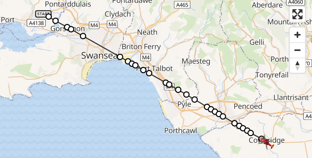
On Monday, 2 March 2026 at 16:54, a Air Ambulance Helicopter departed from Dafen to Cowbridge. It was the Air Ambulance Helicopter with registration number G-WROL. The flight lasted 18 minutes. During that period, the aircraft travelled 36 miles at an average speed of 122 miles per hour at a maximum altitude of 1975 feet.

Helicopter: G-WROL
The helicopter G-WROL is used as a air ambulance helicopter. The main purpose of this aircraft is to transport a Mobile Medical Team to an incident as quickly as possible, enabling the trauma doctor to provide immediate first aid on site. The aircraft is flying this flight as Air Ambulance Helicopter.
Photo: James from Cheltenham, Gloucestershire
37 miles
1975 feet
122 mph
18 minutes
16:54
17:11

Route
Bessant Close, 17:11
Cowbridge17:07
Penllyn17:07
Llangan17:06
Treoes17:06
Coychurch Lower17:06
Coychurch17:06
Bridgend17:05
Cefn Glas17:05
Bryntirion17:04
Pen-y-fai17:04
Laleston17:04
Cefn Cribwr17:03
Pen y Bryn17:03
Coed Hirwaun17:02
Margam17:02
Port Talbot17:01
Margam Moors17:00
Sandfields East17:00
Sandfields17:00
Jersey Marine16:59
Baglan Bay16:59
Jersey Marine16:59
Swansea16:56
Gorseinon16:56
Upper Loughor, Gorseinon16:56
Gorseinon16:55
Llangennech16:54
Penprys Road, 16:54
Live flights
Today
Police Helicopter to RAF Benson20:51:51
Flights Cowbridge
Flights Dafen
Air Ambulance Helicopter to Cardiff Heliport1 Mar 17:46
Air Ambulance Helicopter to Dafen, Heol Aur1 Mar 11:36
Air Ambulance Helicopter to Cardiff Heliport28 Feb 18:00
Air Ambulance Helicopter to Dafen, Heol Aur28 Feb 16:59
Air Ambulance Helicopter to Dafen, Heol Aur28 Feb 13:27
Helicopter flights on your website?
You can easily display helicopter flights on your own website. Use the embed code.
