Air Ambulance Helicopter to Merthyr Tydfil, Glasier Road
Monday, 2 March 2026 | 11:14 | From Dafen
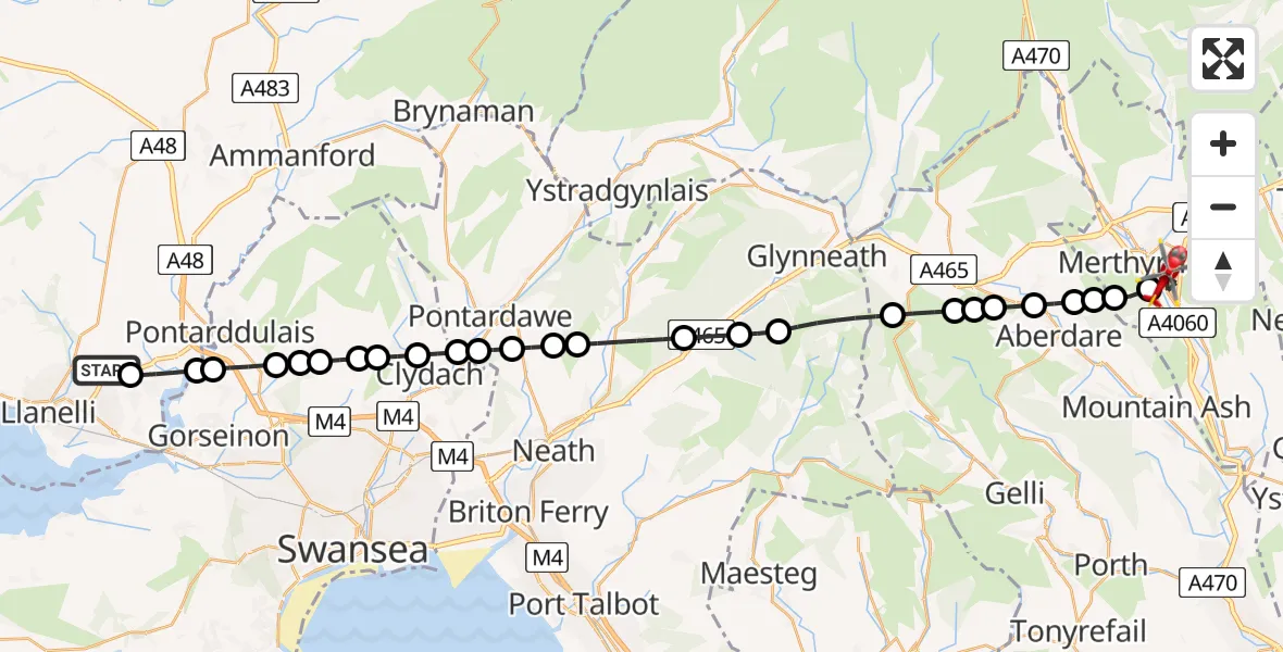
On Monday, 2 March 2026 at 11:14, a Air Ambulance Helicopter departed from Dafen to Merthyr Tydfil. It was the Air Ambulance Helicopter with registration number G-WROL. The flight lasted 15 minutes. During that period, the aircraft travelled 33 miles at an average speed of 133 miles per hour at a maximum altitude of 2650 feet.
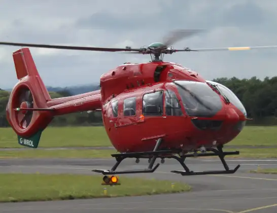
Helicopter: G-WROL
The helicopter G-WROL is used as a air ambulance helicopter. The main purpose of this aircraft is to transport a Mobile Medical Team to an incident as quickly as possible, enabling the trauma doctor to provide immediate first aid on site. The aircraft is flying this flight as Air Ambulance Helicopter.
Photo: James from Cheltenham, Gloucestershire
34 miles
2650 feet
133 mph
16 minutes
11:14
11:29

Route
Glasier Road, 11:29
Merthyr Tydfil11:28
Troed-y-rhiw11:28
Abernant11:27
Aberdare East11:27
Trecynon11:27
Penywaun11:26
Pen-y-Waun11:26
Hirwaun11:26
Rhigos11:25
Blaengwrach11:23
Resolven11:23
Abergarwed11:22
Crynant11:21
Cilybebyll11:21
Rhos11:20
Trebanos11:20
Trebanos, Pontardawe11:19
Clydach11:19
Craig-cefn-parc11:18
Mawr11:18
Felindre11:18
Mawr11:17
Pontlliw11:17
Pontarddulais11:16
Hendy11:16
Llangennech11:15
Heol Aur, 11:14
Live flights
Today
Flights Dafen
Air Ambulance Helicopter to Dafen, Heol Aur13 Jul 18:27
Air Ambulance Helicopter to Barry, Waycock Road13 Jul 14:28
Air Ambulance Helicopter to Dafen, Heol Aur13 Jul 12:46
Air Ambulance Helicopter to Cray13 Jul 10:03
Air Ambulance Helicopter to Dafen, Heol Aur12 Jul 16:00
Air Ambulance Helicopter to Nantmel, A4412 Jul 13:50
Air Ambulance Helicopter to Dafen, Heol Aur12 Jul 08:18
Air Ambulance Helicopter to Dafen, Heol Aur11 Jul 18:18
Air Ambulance Helicopter to Llywel11 Jul 15:17
Air Ambulance Helicopter to Dafen, Heol Aur11 Jul 11:03
Helicopter flights on your website?
You can easily display helicopter flights on your own website. Use the embed code.
