Air Ambulance Helicopter to Churchlands Farm Airstrip
Monday, 2 March 2026 | 15:41 | From Roedean
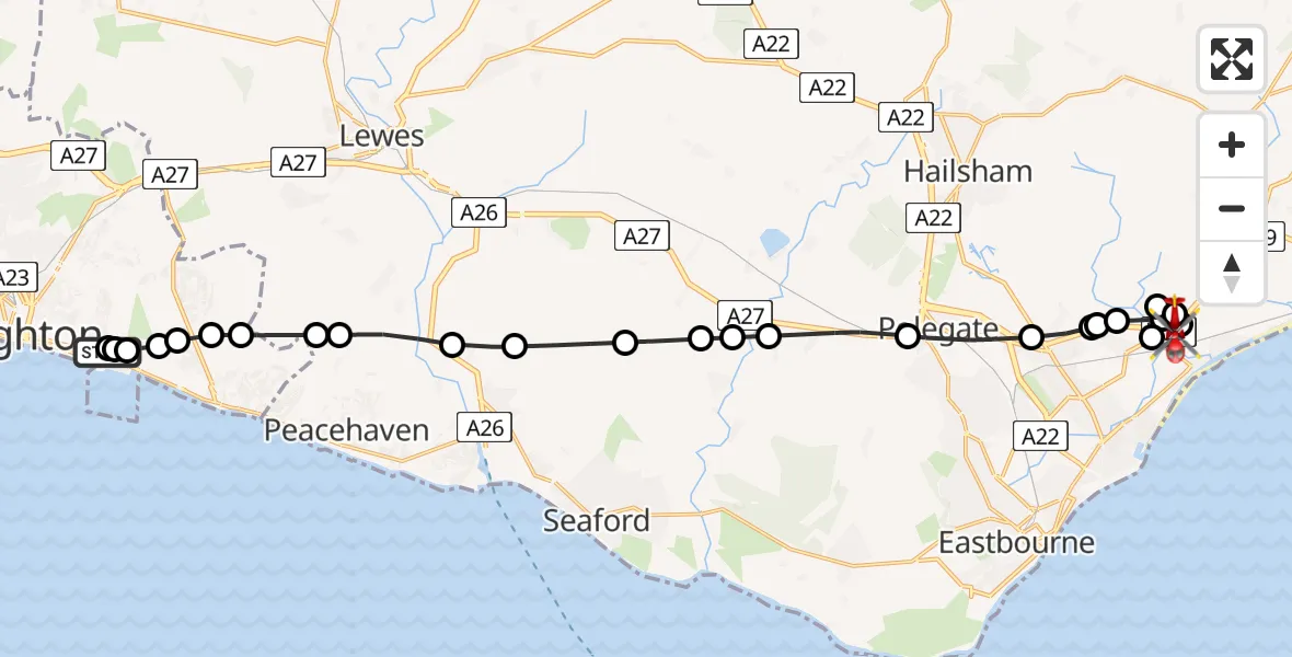
On Monday, 2 March 2026 at 15:41, a Air Ambulance Helicopter departed from Roedean to Churchlands Farm Airstrip. It was the Air Ambulance Helicopter with registration number G-KSSC. The flight lasted 11 minutes. During that period, the aircraft travelled 22 miles at an average speed of 120 miles per hour at a maximum altitude of 1325 feet.
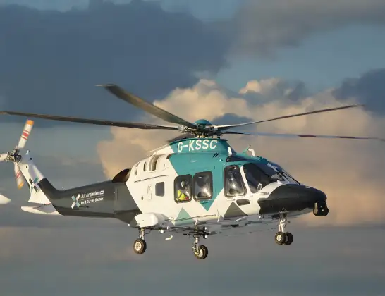
Helicopter: G-KSSC
The helicopter G-KSSC is used as a air ambulance helicopter. The main purpose of this aircraft is to transport a Mobile Medical Team to an incident as quickly as possible, enabling the trauma doctor to provide immediate first aid on site. The aircraft is flying this flight as Air Ambulance Helicopter.
Photo: Shona aakss
22 miles
1325 feet
120 mph
11 minutes
15:41
15:52

Route
Churchlands Farm Airstrip, Pevensey, Kent15:52
Wartling, Wealden15:52
Pevensey, Wealden15:51
Churchlands Farm Airstrip, Pevensey, Kent15:51
Pevensey, Wealden15:50
Churchlands Farm Airstrip, Pevensey, Kent15:50
Pevensey, Wealden15:50
Westham, Wealden15:49
Hankham, Wealden15:49
Stone Cross, Wealden15:49
Polegate, Wealden15:48
Wilmington, Wealden15:47
Alfriston, Wealden15:47
Berwick, Wealden15:46
Alciston, Wealden15:46
Lewes15:45
South Heighton, Lewes15:45
Southease, Lewes15:44
Lewes15:44
Brighton15:43
Rottingdean15:43
Brighton15:43
Ovingdean15:42
Brighton15:42
Roedean15:42
Brighton15:42
Roedean Road, 15:41
Live flights
Today
Flights Roedean
Air Ambulance Helicopter to Redhill Aerodrome12 Feb 17:28
Helicopter flights on your website?
You can easily display helicopter flights on your own website. Use the embed code.
