Police Helicopter to Stirling, Laurelhill Business Park
Monday, 2 March 2026 | 10:33 | From Plains
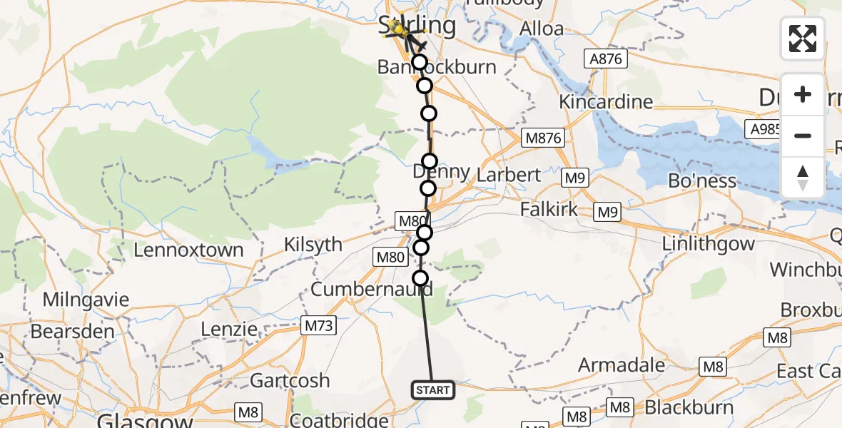
On Monday, 2 March 2026 at 10:33, a Police Helicopter departed from Plains to Stirling. It was the Police Helicopter with registration number G-PSHU. The flight lasted 7 minutes. During that period, the aircraft travelled 18 miles at an average speed of 163 miles per hour at a maximum altitude of 1775 feet.
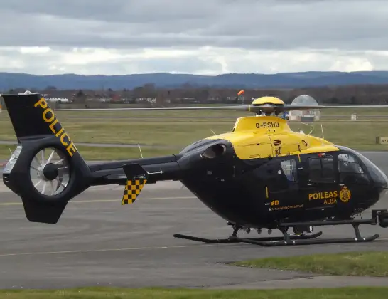
Helicopter: G-PSHU
The helicopter G-PSHU is used by the British police. The helicopter is deployed in pursuits, missing persons cases and other incidents where a helicopter provides added value.
Photo: James from Cheltenham, Gloucestershire
18 miles
1775 feet
163 mph
7 minutes
10:33
10:39

Route
Laurelhill Business Park, 10:39
Stirling10:39
Plean10:38
Bannockburn10:37
Dunipace10:36
Head of Muir10:36
Allandale10:35
Cumbernauld10:35
Abronhill10:34
Main Street, 10:33
Live flights
Air Ambulance Helicopter on its way from Devizes14 Jul 22:59
Police Helicopter on its way from Thames View14 Jul 22:44
Police Helicopter on its way from Brandy Carr14 Jul 22:00
Today
Air Ambulance Helicopter to Cardiff Heliport14 Jul 22:43
Coastguard Helicopter to North Sea14 Jul 22:40
Air Ambulance Helicopter to North Sea14 Jul 22:27
Air Ambulance Helicopter to Priory Farm Airstrip14 Jul 22:16
Air Ambulance Helicopter to Papworth Hospital14 Jul 22:02
Air Ambulance Helicopter to Redhill Aerodrome14 Jul 21:58
Coastguard Helicopter to North Sea14 Jul 21:56
Flights Stirling
Police Helicopter to Linwood, B81814 Jul 13:04
Air Ambulance Helicopter to Inner Seas12 Jul 20:45
Police Helicopter to Stirling, New Line Road12 Jul 14:32
Coastguard Helicopter to Killin, Stirling22 Jun 14:48
Coastguard Helicopter to Killin, Stirling22 Jun 14:24
Coastguard Helicopter to Stirling, A8421 Jun 16:32
Flights Plains
Helicopter flights on your website?
You can easily display helicopter flights on your own website. Use the embed code.
