Air Ambulance Helicopter to Edenbridge, Lingfield Road
Monday, 2 March 2026 | 10:20 | From Redhill Aerodrome
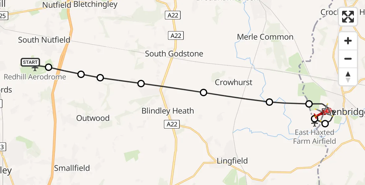
On Monday, 2 March 2026 at 10:20, a Air Ambulance Helicopter departed from Redhill Aerodrome to Edenbridge. It was the Air Ambulance Helicopter with registration number G-LNAC. The flight lasted 8 minutes. During that period, the aircraft travelled 10 miles at an average speed of 78 miles per hour at a maximum altitude of 1000 feet.
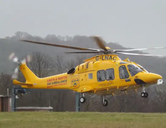
Helicopter: G-LNAC
The helicopter G-LNAC is used as a air ambulance helicopter. The main purpose of this aircraft is to transport a Mobile Medical Team to an incident as quickly as possible, enabling the trauma doctor to provide immediate first aid on site. The aircraft is flying this flight as Air Ambulance Helicopter.
Photo: James from Cheltenham, Gloucestershire
10 miles
1000 feet
78 mph
8 minutes
10:20
10:28

Route
Lingfield Road, 10:28
Edenbridge10:27
East Haxted Farm Airfield, Edenbridge, Kent10:26
Edenbridge10:26
Tandridge10:25
Crowhurst10:24
Blindley Heath10:24
Tandridge10:23
Outwood10:23
South Nutfield10:22
Redhill Aerodrome, Redhill, Surrey10:22
Redhill Aerodrome, Redhill, Surrey10:20
Today
Flights Edenbridge
Police Helicopter to Edenbridge, Hever Road22 May 13:10
Police Helicopter to Redhill, Rosemead Close27 Jan 00:14
Police Helicopter to Edenbridge26 Jan 23:45
Helicopter flights on your website?
You can easily display helicopter flights on your own website. Use the embed code.
