Air Ambulance Helicopter to Prestbury, Evesham Road
Sunday, 1 March 2026 | 9:36 | From Hill Croome
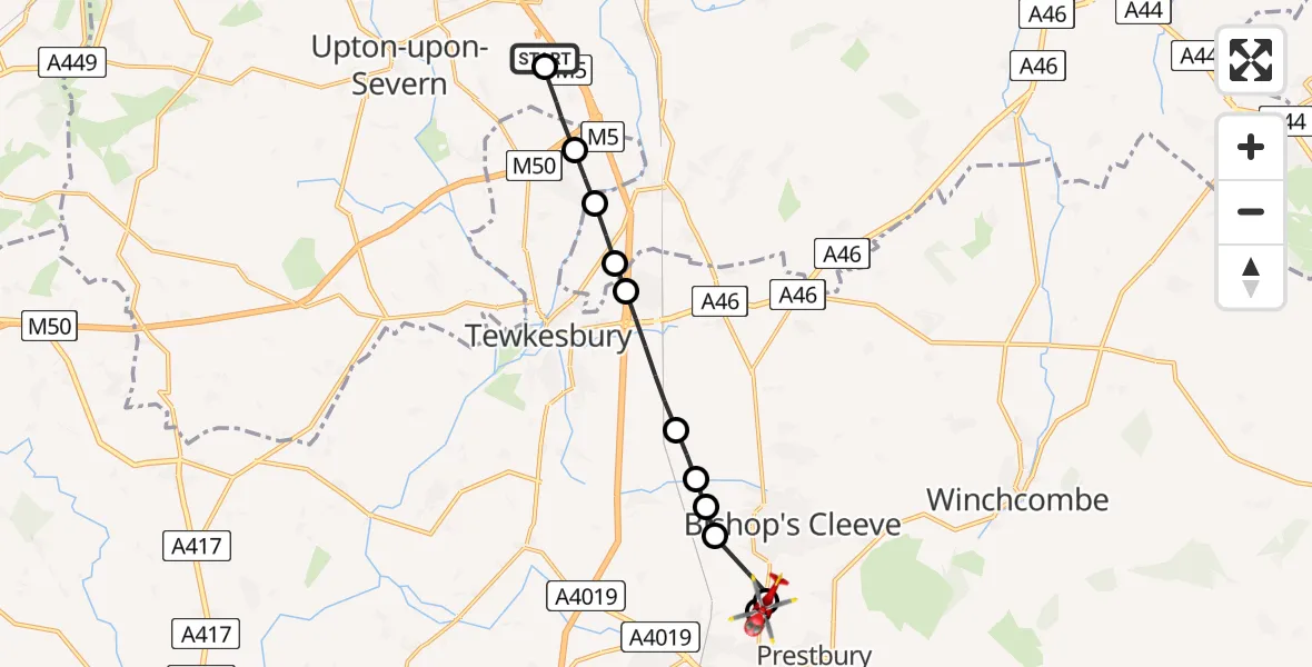
On Sunday, 1 March 2026 at 9:36, a Air Ambulance Helicopter departed from Hill Croome to Prestbury. It was the Air Ambulance Helicopter with registration number G-OMAA. The flight lasted 7 minutes. During that period, the aircraft travelled 11 miles at an average speed of 95 miles per hour at a maximum altitude of 950 feet.
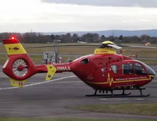
Helicopter: G-OMAA
The helicopter G-OMAA is used as a air ambulance helicopter. The main purpose of this aircraft is to transport a Mobile Medical Team to an incident as quickly as possible, enabling the trauma doctor to provide immediate first aid on site. The aircraft is flying this flight as Air Ambulance Helicopter.
Photo: James from Cheltenham, Gloucestershire
11 miles
950 feet
95 mph
7 minutes
09:36
09:43

Route
Prestbury, Cheltenham09:43
Prestbury, Cheltenham09:43
Evesham Road, Cheltenham09:42
Swindon, Cheltenham09:42
Bishop's Cleeve09:41
Stoke Orchard, Bishop's Cleeve09:41
Tewkesbury09:40
Tredington, Tewkesbury09:40
Tewkesbury09:39
Bredon, Tewkesbury09:38
Bredon, Wychavon09:38
Twyning, Tewkesbury09:37
Twyning Road, Wychavon09:37
Upper Strensham, Wychavon09:36
Hill Croome, Malvern Hills09:36
Live flights
Police Helicopter on its way from MOD St Athan15 Jul 23:53
Police Helicopter on its way from Wrenthorpe15 Jul 23:36
Today
Police Helicopter to Glasgow, Renfrew Road15 Jul 23:45
Police Helicopter to Manchester Barton Aerodrome15 Jul 23:33
Police Helicopter to Renfrewshire15 Jul 23:32
Air Ambulance Helicopter to Southampton Airport15 Jul 23:30
Flights Prestbury
Air Ambulance Helicopter to Prestbury, New Road26 Jun 07:36
Helicopter flights on your website?
You can easily display helicopter flights on your own website. Use the embed code.
