Air Ambulance Helicopter to Henstridge Airfield
Saturday, 28 February 2026 | 20:38 | From Highbridge
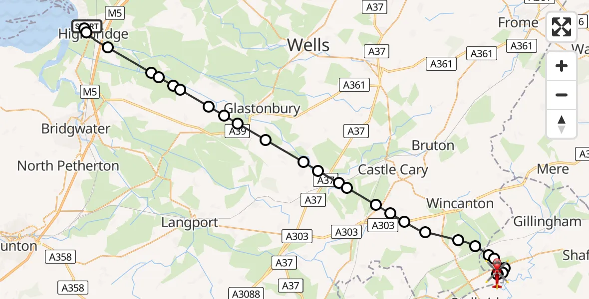
On Saturday, 28 February 2026 at 20:38, a Air Ambulance Helicopter departed from Highbridge to Henstridge Airfield. It was the Air Ambulance Helicopter with registration number G-DSAA. The flight lasted 22 minutes. During that period, the aircraft travelled 34 miles at an average speed of 94 miles per hour at a maximum altitude of 1025 feet.
Helicopter: G-DSAA
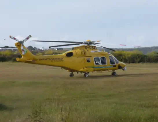
The helicopter G-DSAA is used as a air ambulance helicopter. The main purpose of this aircraft is to transport a Mobile Medical Team to an incident as quickly as possible, enabling the trauma doctor to provide immediate first aid on site. The aircraft is flying this flight as Air Ambulance Helicopter.
Photo: Andrew Bone
34 miles
1025 feet
94 mph
22 minutes
20:38
21:00

Route
Henstridge Airfield, Templecombe, Somerset21:00
Henstridge Airfield, Templecombe, Somerset20:59
Henstridge Airfield, Templecombe, Somerset20:58
Henstridge Airfield, Templecombe, Somerset20:58
Henstridge20:58
Kington Magna20:57
Fifehead Magdalen20:57
Kington Magna20:56
Buckhorn Weston20:56
Abbas and Templecombe20:56
Horsington20:55
South Cheriton20:54
Blackford20:53
Woolston20:53
Galhampton20:52
North Barrow20:51
Lovington20:51
Lydford-on-Fosse20:50
Barton St. David20:50
Butleigh20:49
Street20:48
Walton20:47
Ashcott20:47
Shapwick20:46
Burtle20:45
Edington20:45
Chilton Polden20:45
East Huntspill20:43
Ryeland Street, 20:42
Highbridge20:42
Burnham-on-Sea20:42
Highbridge20:38
Live flights
Police Helicopter on its way from MOD St Athan15 Jul 23:53
Police Helicopter on its way from Wrenthorpe15 Jul 23:36
Today
Police Helicopter to Glasgow, Renfrew Road15 Jul 23:45
Police Helicopter to Manchester Barton Aerodrome15 Jul 23:33
Police Helicopter to Renfrewshire15 Jul 23:32
Air Ambulance Helicopter to Southampton Airport15 Jul 23:30
Flights Highbridge
Air Ambulance Helicopter to Henstridge Airfield22 Apr 11:27
Air Ambulance Helicopter to Highbridge18 Apr 11:09
Air Ambulance Helicopter to Henstridge Airfield28 Feb 20:38
Helicopter flights on your website?
You can easily display helicopter flights on your own website. Use the embed code.
