Air Ambulance Helicopter to Pentrich CP, Asher Lane
Saturday, 28 February 2026 | 13:00 | From Loughborough
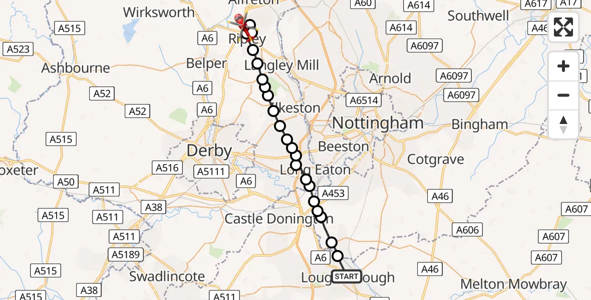
On Saturday, 28 February 2026 at 13:00, a Air Ambulance Helicopter departed from Loughborough to Pentrich CP. It was the Air Ambulance Helicopter with registration number G-DRLA. The flight lasted 10 minutes. During that period, the aircraft travelled 24 miles at an average speed of 146 miles per hour at a maximum altitude of 1125 feet.
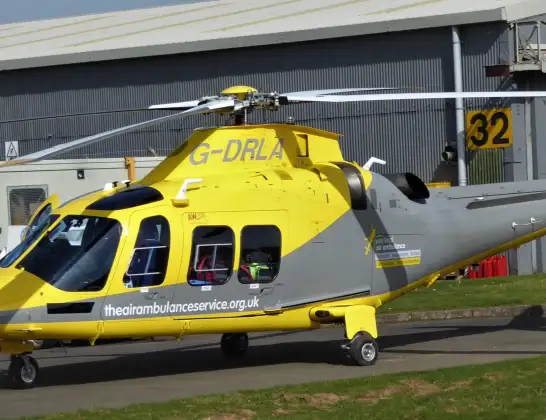
Helicopter: G-DRLA
The helicopter G-DRLA is used as an ambulance helicopter. The helicopter is equipped with a stretcher for transporting patients. The helicopter is often used to transport to hospitals.
Photo: Alec Wilson
24 miles
1125 feet
146 mph
10 minutes
13:00
13:10

Route
Asher Lane, Amber Valley13:10
Ripley, Amber Valley13:09
Swanwick CP, Amber Valley13:09
Ripley, Amber Valley13:08
Waingroves, Ripley13:08
Denby CP, Amber Valley13:07
Smalley CP, Heanor13:07
Shipley, Heanor13:06
Mapperley, Amber Valley13:06
West Hallam, Erewash13:06
Dale Abbey, Erewash13:05
Stanton by Dale, Erewash13:05
Risley, Derby13:04
Risley, Erewash13:04
Breaston, Derby13:04
Long Eaton, City of Nottingham13:03
Sawley, Erewash13:03
North West Leicestershire13:03
Ratcliffe on Soar, City of Nottingham13:02
Kingston on Soar, City of Nottingham13:02
Sutton Bonington, Rushcliffe13:01
Normanton on Soar, Rushcliffe13:01
Canal Bank, Charnwood13:00
Live flights
Today
Flights Loughborough
Air Ambulance Helicopter to Nottingham Heliport23 Feb 17:49
Helicopter flights on your website?
You can easily display helicopter flights on your own website. Use the embed code.
