Coastguard Helicopter to High Peak, Snake Road
Saturday, 28 February 2026 | 18:41 | From Sheffield
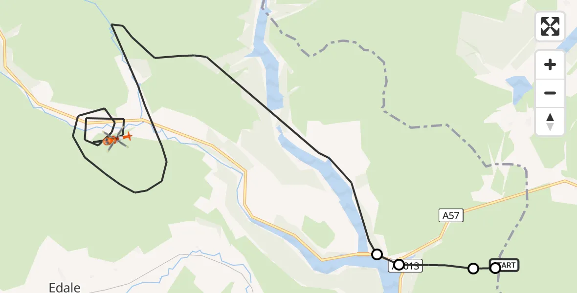
On Saturday, 28 February 2026 at 18:41, a Coastguard Helicopter departed from Sheffield to High Peak. It was the Coastguard Helicopter with registration number G-MCGE. The flight lasted 27 minutes. During that period, the aircraft travelled 15 miles at an average speed of 35 miles per hour at a maximum altitude of 2100 feet.
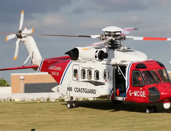
Helicopter: G-MCGE
The helicopter G-MCGE is used by the British Coastguard. The helicopter is deployed in search and rescue operations at sea, rescue operations involving ships or drilling platforms, patrols to prevent smuggling or piracy, environmental monitoring and disaster relief support.
Photo: Mike Burdett
16 miles
2100 feet
35 mph
27 minutes
18:41
19:07

Route
Snake Road, East Midlands19:07
High Peak, East Midlands18:44
Ladybower Reservoir18:44
High Peak, East Midlands18:43
Hathersage, Derbyshire Dales18:43
Sheffield, South Yorkshire18:41
Live flights
Today
Flights Sheffield
Coastguard Helicopter to Humberside Airport22 Mar 15:25
Coastguard Helicopter to Ladybower Reservoir22 Mar 14:12
Air Ambulance Helicopter to Nottingham Heliport22 Mar 13:55
Air Ambulance Helicopter to Nottingham Heliport10 Mar 11:10
Helicopter flights on your website?
You can easily display helicopter flights on your own website. Use the embed code.
