Air Ambulance Helicopter to Peniel, Castell Pigyn Road
Saturday, 28 February 2026 | 12:12 | From Lledrod
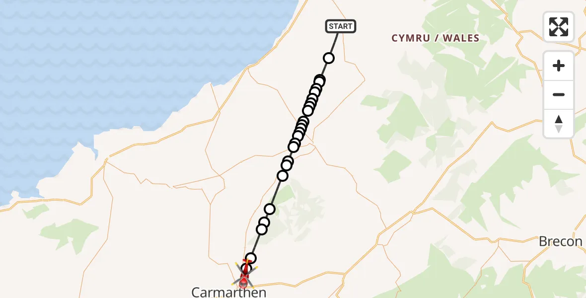
On Saturday, 28 February 2026 at 12:12, a Air Ambulance Helicopter departed from Lledrod to Peniel. It was the Air Ambulance Helicopter with registration number G-WROL. The flight lasted 14 minutes. During that period, the aircraft travelled 31 miles at an average speed of 130 miles per hour at a maximum altitude of 2125 feet.
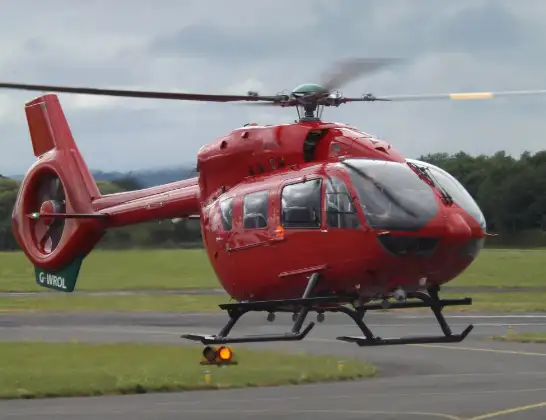
Helicopter: G-WROL
The helicopter G-WROL is used as a air ambulance helicopter. The main purpose of this aircraft is to transport a Mobile Medical Team to an incident as quickly as possible, enabling the trauma doctor to provide immediate first aid on site. The aircraft is flying this flight as Air Ambulance Helicopter.
Photo: James from Cheltenham, Gloucestershire
32 miles
2125 feet
130 mph
15 minutes
12:12
12:26

Route
Castell Pigyn Road, 12:26
Peniel12:26
Rhydargaeau12:25
Llanllawddog12:24
Llanfihangel-ar-Arth12:23
Brechfa12:22
Llanllwni12:20
Llanybydder12:20
Pencarreg12:20
Llanwnnen12:19
Capel-y-Groes12:19
Cribyn12:18
Llanwnnen12:18
Temple Bar12:18
Silian12:18
Llangybi12:17
Llanfihangel Ystrad12:17
Felindre12:17
Nantcwnlle12:16
Felindre12:16
Bwlchllan12:16
Tal-sarn12:15
Nantcwnlle12:15
Moelfryn12:15
Llangeitho12:14
Lledrod, 12:12
Live flights
Today
Police Helicopter to MOD St Athan15 Jul 23:53
Police Helicopter to East Ardsley, Stoney Lane15 Jul 23:36
Flights Peniel
Air Ambulance Helicopter to Peniel17 Jun 19:33
Police Helicopter to Peniel, B450111 Jun 22:29
Air Ambulance Helicopter to Dafen, Heol Aur27 May 18:19
Air Ambulance Helicopter to Peniel, A48527 May 17:01
Air Ambulance Helicopter to Peniel25 May 23:26
Flights Lledrod
Air Ambulance Helicopter to Lledrod, A48528 Feb 10:50
Helicopter flights on your website?
You can easily display helicopter flights on your own website. Use the embed code.
