Police Helicopter to Benson, Brook Street
Friday, 27 February 2026 | 18:19 | From Streatley
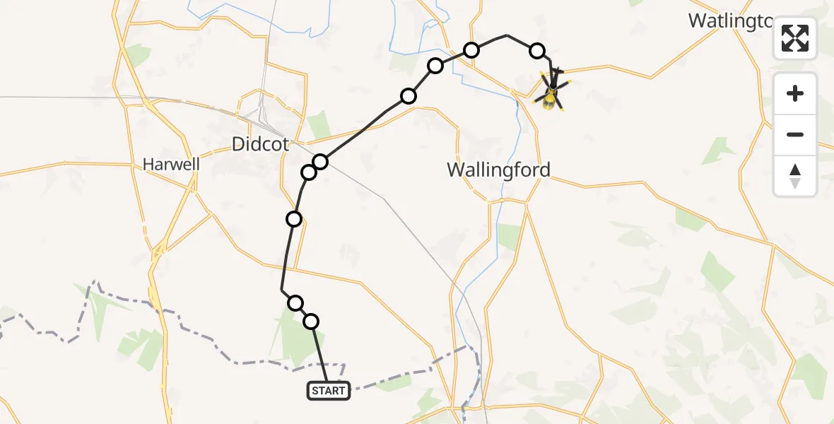
On Friday, 27 February 2026 at 18:19, a Police Helicopter departed from Streatley to Benson. It was the Police Helicopter with registration number G-POLF. The flight lasted 6 minutes. During that period, the aircraft travelled 12 miles at an average speed of 126 miles per hour at a maximum altitude of 1500 feet.
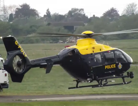
Helicopter: G-POLF
The helicopter G-POLF is used by the British police. The helicopter is deployed in pursuits, missing persons cases and other incidents where a helicopter provides added value.
Photo: James
13 miles
1500 feet
126 mph
6 minutes
18:19
18:25

Route
Brook Street, South Oxfordshire18:25
Berrick Salome, South Oxfordshire18:24
Warborough, South Oxfordshire18:23
Shillingford, South Oxfordshire18:23
Brightwell-cum-Sotwell, South Oxfordshire18:22
North Moreton, South Oxfordshire18:21
East Hagbourne, Didcot18:21
East Hagbourne, South Oxfordshire18:21
Blewbury, Vale of White Horse18:20
Aston Upthorpe, South Oxfordshire18:19
The Ridgeway, 18:19
Live flights
Today
Police Helicopter to Newmilns20:50:25
Flights Benson
Police Helicopter to Ewelme26 Feb 19:25
Police Helicopter to Benson, The Sands25 Feb 22:31
Police Helicopter to Ewelme25 Feb 19:01
Police Helicopter to Benson19 Feb 19:43
Police Helicopter to Benson, Clack's Lane19 Feb 15:39
Police Helicopter to Benson, Clack's Lane18 Feb 17:38
Police Helicopter to Benson, The Sands16 Feb 19:51
Police Helicopter to Ewelme, The Sands15 Feb 20:41
Flights Streatley
Helicopter flights on your website?
You can easily display helicopter flights on your own website. Use the embed code.
