Police Helicopter to Benson, Clack's Lane
Wednesday, 18 February 2026 | 17:38 | From Ewelme
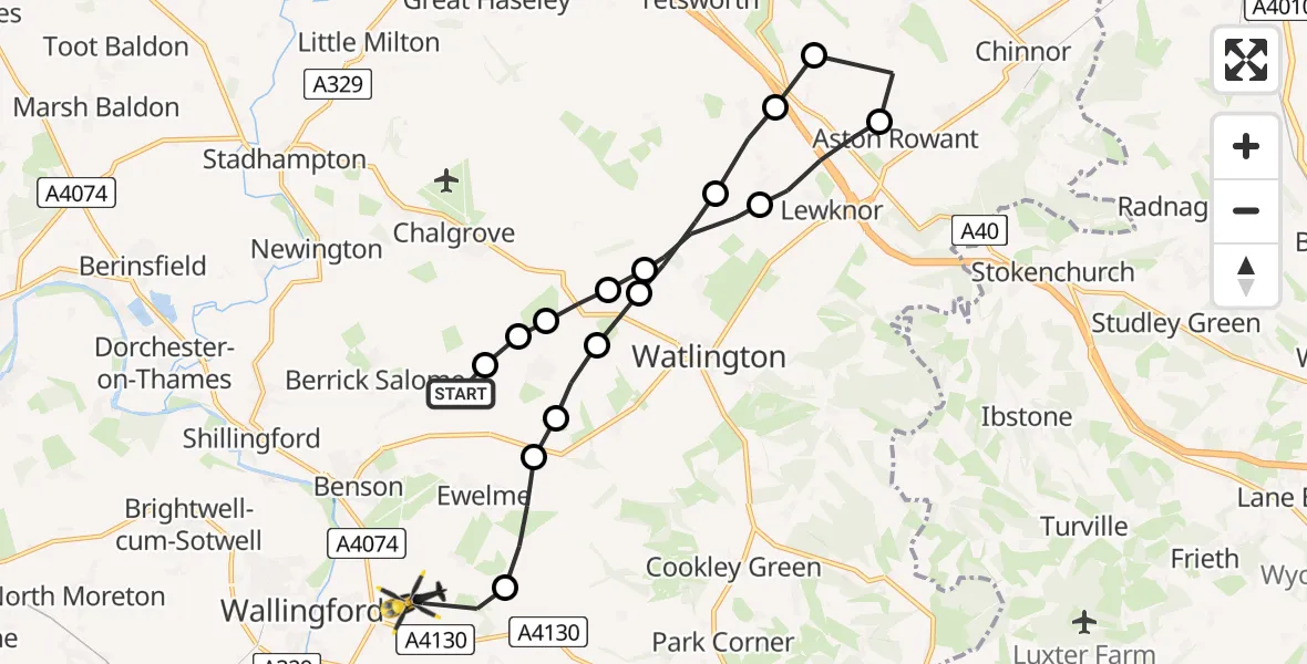
On Wednesday, 18 February 2026 at 17:38, a Police Helicopter departed from Ewelme to Benson. It was the Police Helicopter with registration number G-POLF. The flight lasted 8 minutes. During that period, the aircraft travelled 17 miles at an average speed of 128 miles per hour at a maximum altitude of 1800 feet.
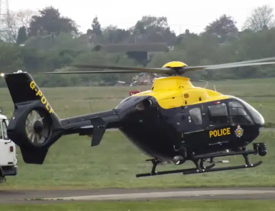
Helicopter: G-POLF
The helicopter G-POLF is used by the British police. The helicopter is deployed in pursuits, missing persons cases and other incidents where a helicopter provides added value.
Photo: James
18 miles
1800 feet
128 mph
9 minutes
17:38
17:46

Route
Clack's Lane, South Oxfordshire17:46
Benson, South Oxfordshire17:45
Ewelme, South Oxfordshire17:44
South Oxfordshire17:44
Cuxham, South Oxfordshire17:44
Cuxham, Watlington17:43
South Oxfordshire17:43
Postcombe, South Oxfordshire17:42
Lewknor, South Oxfordshire17:42
Aston Rowant, South Oxfordshire17:41
Lewknor, South Oxfordshire17:40
South Oxfordshire17:39
Cuxham, Watlington17:39
Cuxham, South Oxfordshire17:39
Chalgrove, South Oxfordshire17:38
South Oxfordshire17:38
Hollandtide Lane, South Oxfordshire17:38
Live flights
Today
Flights Benson
Air Ambulance Helicopter to Benson10 Jul 09:43
Police Helicopter to Benson, Clack's Lane2 Jul 19:06
Police Helicopter to Benson, A41301 Jul 15:27
Police Helicopter to Benson, Braze Lane1 Jul 13:48
Police Helicopter to RAF Benson30 Jun 19:42
Police Helicopter to Benson, The Sands30 Jun 15:07
Police Helicopter to Benson, The Sands28 Jun 21:41
Police Helicopter to Benson, Clack's Lane28 Jun 17:16
Police Helicopter to RAF Benson27 Jun 19:48
Flights Ewelme
Police Helicopter to RAF Benson12 Jul 13:27
Police Helicopter to Berrick Salome, Benson10 Jul 18:22
Police Helicopter to Berrick Salome, Benson10 Jul 17:26
Police Helicopter to Ewelme5 Jul 20:13
Helicopter flights on your website?
You can easily display helicopter flights on your own website. Use the embed code.
