Police Helicopter to Moulsford, Cow Lane
Friday, 27 February 2026 | 18:09 | From Nuffield
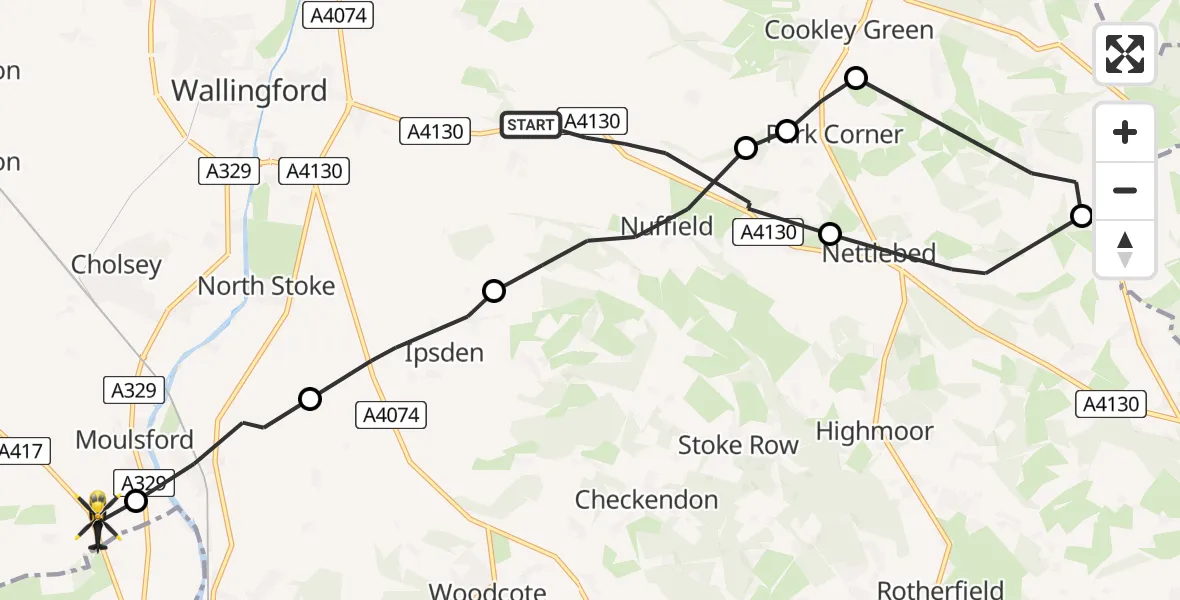
On Friday, 27 February 2026 at 18:09, a Police Helicopter departed from Nuffield to Moulsford. It was the Police Helicopter with registration number G-POLF. The flight lasted 8 minutes. During that period, the aircraft travelled 16 miles at an average speed of 118 miles per hour at a maximum altitude of 1500 feet.
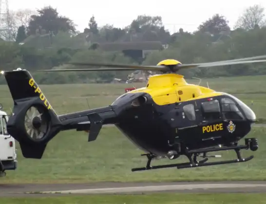
Helicopter: G-POLF
The helicopter G-POLF is used by the British police. The helicopter is deployed in pursuits, missing persons cases and other incidents where a helicopter provides added value.
Photo: James
17 miles
1500 feet
118 mph
9 minutes
18:09
18:17

Route
Cow Lane, South Oxfordshire18:17
Moulsford, South Oxfordshire18:17
South Stoke, South Oxfordshire18:16
Ipsden, South Oxfordshire18:15
Nuffield, South Oxfordshire18:14
Park Corner, South Oxfordshire18:14
Cookley Green, South Oxfordshire18:13
South Oxfordshire18:12
Nettlebed, South Oxfordshire18:10
A4130, South Oxfordshire18:09
Live flights
Air Ambulance Helicopter on its way from Ashford14 Jul 23:46
Coastguard Helicopter on its way from North Sea14 Jul 23:44
Today
Coastguard Helicopter to North Sea14 Jul 23:30
Police Helicopter to Inner Seas14 Jul 23:12
Air Ambulance Helicopter to Norwich Airport14 Jul 22:52
Police Helicopter to Manchester Barton Aerodrome14 Jul 22:50
Police Helicopter to Sewardstonebury, Bury Road14 Jul 22:44
Air Ambulance Helicopter to Cardiff Heliport14 Jul 22:43
Coastguard Helicopter to North Sea14 Jul 22:40
Flights Moulsford
Police Helicopter to Moulsford, Cow Lane27 Feb 18:09
Flights Nuffield
Police Helicopter to Benson, Clack's Lane28 Jun 17:16
Police Helicopter to Benson, The Sands1 Jun 13:25
Police Helicopter to Ewelme, Nolay Close28 May 15:14
Police Helicopter to Ewelme20 May 13:24
Air Ambulance Helicopter to Oxford, Headley Way19 Apr 08:11
Helicopter flights on your website?
You can easily display helicopter flights on your own website. Use the embed code.
