Air Ambulance Helicopter to YAA Nostell Helicopter Port
Thursday, 26 February 2026 | 12:54 | From Lindley
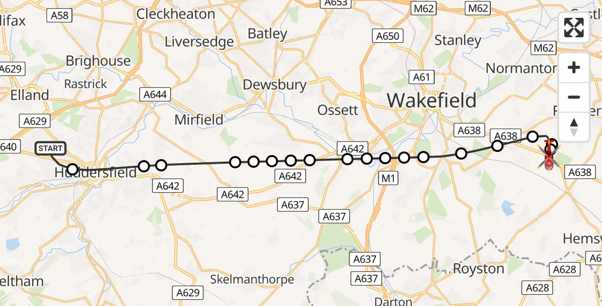
On Thursday, 26 February 2026 at 12:54, a Air Ambulance Helicopter departed from Lindley to YAA Nostell Helicopter Port. It was the Air Ambulance Helicopter with registration number G-YORX. The flight lasted 13 minutes. During that period, the aircraft travelled 19 miles at an average speed of 89 miles per hour at a maximum altitude of 1725 feet.
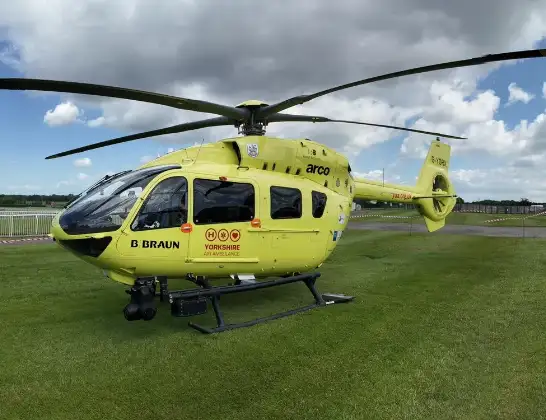
Helicopter: G-YORX
The helicopter G-YORX is used as a air ambulance helicopter. The main purpose of this aircraft is to transport a Mobile Medical Team to an incident as quickly as possible, enabling the trauma doctor to provide immediate first aid on site. The aircraft is flying this flight as Air Ambulance Helicopter.
Photo: Arollin96227
19 miles
1725 feet
89 mph
13 minutes
12:54
13:07

Route
YAA Nostell Helicopter Port, Foulby, Nostell, Yorkshire13:07
YAA Nostell Helicopter Port, Foulby, Nostell, Yorkshire13:06
YAA Nostell Helicopter Port, Foulby, Nostell, Yorkshire13:05
Nostell, Wakefield13:05
Sharlston, Wakefield13:05
Crofton, Wakefield13:04
Walton, Wakefield13:04
Kettlethorpe, Wakefield13:03
Durkar, Wakefield13:03
Calder Grove, Wakefield13:03
Horbury, Wakefield13:02
Horbury Bridge, Wakefield13:02
Middlestown, Wakefield13:02
Overton, Wakefield13:01
Kirkburton, Kirklees13:01
Overthorpe, Kirklees13:01
Grange Moor, Kirklees13:01
Kirkburton, Kirklees13:00
Lascelles Hall, Kirklees12:59
Huddersfield, Kirklees12:58
Stanley Road, Kirklees12:57
Lindley, Kirklees12:54
Live flights
Today
Police Helicopter to Manchester Barton Aerodrome13 Jul 23:56
Police Helicopter to Bournemouth Airport13 Jul 23:55
Air Ambulance Helicopter to Cardiff Heliport13 Jul 23:38
Police Helicopter to Harborough, Sulby Road13 Jul 23:36
Police Helicopter to Birmingham Airport13 Jul 23:21
Police Helicopter to Irlam, Twelve Yards Road13 Jul 23:00
Flights Lindley
Police Helicopter to Wrenthorpe, Stoney Lane12 May 20:30
Police Helicopter to Lindley, Union Street12 May 20:06
Air Ambulance Helicopter to RAF Topcliffe20 Jan 18:22
Helicopter flights on your website?
You can easily display helicopter flights on your own website. Use the embed code.
