Air Ambulance Helicopter to Down Hatherley, Cheltenham Road East
Thursday, 26 February 2026 | 10:38 | From Churchdown
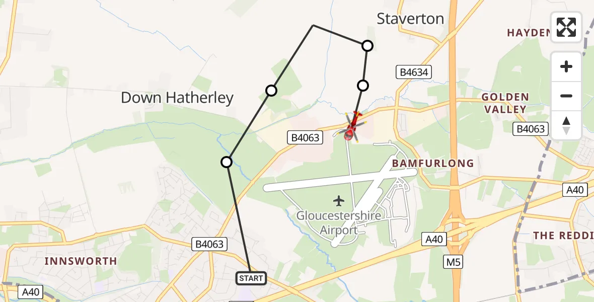
On Thursday, 26 February 2026 at 10:38, a Air Ambulance Helicopter departed from Churchdown to Down Hatherley. It was the Air Ambulance Helicopter with registration number G-SCAA. The flight lasted 2 minutes. During that period, the aircraft travelled 2 miles at an average speed of 92 miles per hour at a maximum altitude of 1525 feet.
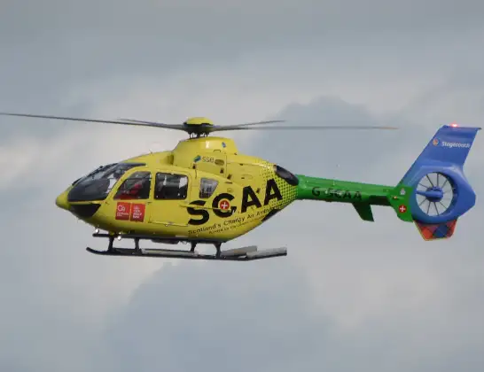
Helicopter: G-SCAA
The helicopter G-SCAA is used as a air ambulance helicopter. The main purpose of this aircraft is to transport a Mobile Medical Team to an incident as quickly as possible, enabling the trauma doctor to provide immediate first aid on site. The aircraft is flying this flight as Air Ambulance Helicopter.
Photo: Jonathan Payne
3 miles
1525 feet
92 mph
2 minutes
10:38
10:40

Route
Cheltenham Road East, Tewkesbury10:40
Down Hatherley, Tewkesbury10:40
Staverton, Tewkesbury10:40
Down Hatherley, Tewkesbury10:39
Gloucester10:39
Golden Vale, Gloucester10:38
Live flights
Police Helicopter on its way from Ewelme13 Jul 22:24
Today
Police Helicopter to Bournemouth Airport13 Jul 23:55
Air Ambulance Helicopter to Cardiff Heliport13 Jul 23:38
Police Helicopter to Birmingham Airport13 Jul 23:21
Police Helicopter to Irlam, Twelve Yards Road13 Jul 23:00
Flights Churchdown
Air Ambulance Helicopter to Churchdown, A4011 Mar 12:56
Air Ambulance Helicopter to Churchdown, A4011 Mar 10:47
Air Ambulance Helicopter to Churchdown, A4011 Mar 09:17
Air Ambulance Helicopter to Churchdown, A4011 Mar 09:11
Air Ambulance Helicopter to Churchdown, A4010 Mar 15:53
Air Ambulance Helicopter to Churchdown, A4010 Mar 14:15
Air Ambulance Helicopter to Churchdown, A4010 Mar 12:13
Air Ambulance Helicopter to Churchdown, A4010 Mar 10:43
Air Ambulance Helicopter to Churchdown, A4010 Mar 10:37
Air Ambulance Helicopter to Churchdown, A409 Mar 17:20
Helicopter flights on your website?
You can easily display helicopter flights on your own website. Use the embed code.
