to Down Hatherley, Cheltenham Road East
Thursday, 26 February 2026 | 10:38 | From Churchdown
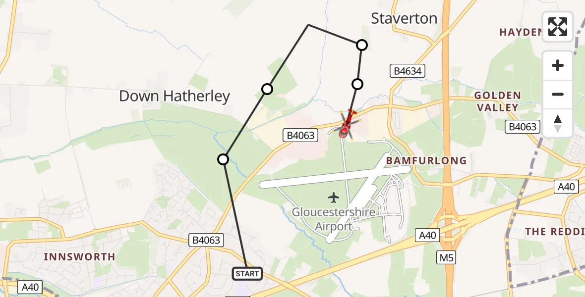
On Thursday, 26 February 2026 at 10:38, a Air Ambulance Helicopter departed from Churchdown to Down Hatherley. It was the Air Ambulance Helicopter with registration number G-SCAA. The flight lasted 2 minutes. During that period, the aircraft travelled 2 miles at an average speed of 92 miles per hour at a maximum altitude of 1525 feet.
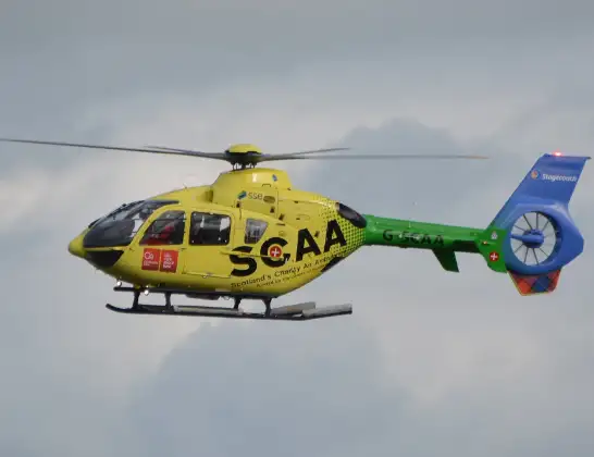
Helicopter: G-SCAA
The helicopter G-SCAA is used as a air ambulance helicopter. The main purpose of this aircraft is to transport a Mobile Medical Team to an incident as quickly as possible, enabling the trauma doctor to provide immediate first aid on site. The aircraft is flying this flight as .
Photo: Jonathan Payne
3 miles
1525 feet
92 mph
2 minutes
10:38
10:40

Route
Cheltenham Road East, Tewkesbury10:40
Down Hatherley, Tewkesbury10:40
Staverton, Tewkesbury10:40
Down Hatherley, Tewkesbury10:39
Gloucester10:39
Golden Vale, Gloucester10:38
Live flights
Today
Flights Churchdown
to Churchdown, A4024 Feb 09:10
Helicopter flights on your website?
You can easily display helicopter flights on your own website. Use the embed code.
