Air Ambulance Helicopter to Nant-y-moel, Commercial Street
Thursday, 26 February 2026 | 9:08 | From Dafen
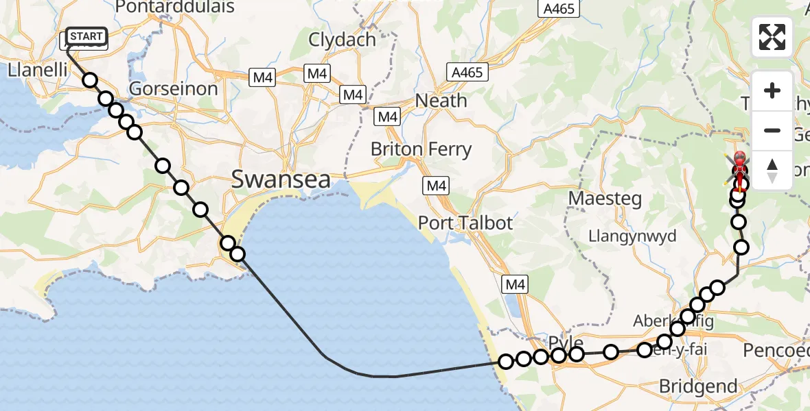
On Thursday, 26 February 2026 at 9:08, a Air Ambulance Helicopter departed from Dafen to Nant-y-moel. It was the Air Ambulance Helicopter with registration number G-WROL. The flight lasted 23 minutes. During that period, the aircraft travelled 39 miles at an average speed of 104 miles per hour at a maximum altitude of 2975 feet.
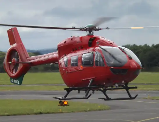
Helicopter: G-WROL
The helicopter G-WROL is used as a air ambulance helicopter. The main purpose of this aircraft is to transport a Mobile Medical Team to an incident as quickly as possible, enabling the trauma doctor to provide immediate first aid on site. The aircraft is flying this flight as Air Ambulance Helicopter.
Photo: James from Cheltenham, Gloucestershire
39 miles
2975 feet
104 mph
23 minutes
09:08
09:30

Route
Commercial Street, 09:30
Nant-y-moel09:27
Price Town09:26
Ogmore Vale09:26
Wyndham09:26
Ogmore Vale09:25
Lewistown09:24
Blackmill09:23
Bryncethin09:23
Brynmenyn09:23
Sarn09:22
Aberkenfig09:22
Pen-y-fai09:22
Laleston09:22
Cefn Cribwr09:21
Pyle09:21
North Cornelly09:20
Mawdlam09:20
Kenfig09:20
Cornelly09:20
Bristol Channel09:15
Mumbles09:14
Swansea09:14
Upper Killay09:13
Dunvant09:13
Three Crosses09:12
Penclawdd09:12
Llanrhidian Higher09:11
Bynea09:11
Llwynhendy09:11
Heol Aur, 09:08
Today
Flights Nant-y-moel
Air Ambulance Helicopter to Dafen, Heol Aur26 Mar 16:46
Air Ambulance Helicopter to Dafen, Heol Aur26 Feb 10:12
Flights Dafen
Air Ambulance Helicopter to Dafen, Heol Aur13 Jul 18:27
Air Ambulance Helicopter to Barry, Waycock Road13 Jul 14:28
Air Ambulance Helicopter to Dafen, Heol Aur13 Jul 12:46
Air Ambulance Helicopter to Cray13 Jul 10:03
Air Ambulance Helicopter to Dafen, Heol Aur12 Jul 16:00
Air Ambulance Helicopter to Nantmel, A4412 Jul 13:50
Air Ambulance Helicopter to Dafen, Heol Aur12 Jul 08:18
Air Ambulance Helicopter to Dafen, Heol Aur11 Jul 18:18
Air Ambulance Helicopter to Llywel11 Jul 15:17
Air Ambulance Helicopter to Dafen, Heol Aur11 Jul 11:03
Helicopter flights on your website?
You can easily display helicopter flights on your own website. Use the embed code.
