Coastguard Helicopter to St. Margaret's at Cliffe, Upper Road
Thursday, 26 February 2026 | 7:46 | From Southend-on-Sea
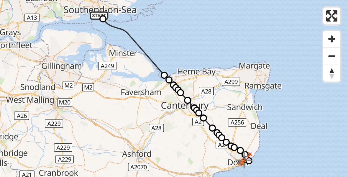
On Thursday, 26 February 2026 at 7:46, a Coastguard Helicopter departed from Southend-on-Sea to St. Margaret's at Cliffe. It was the Coastguard Helicopter with registration number G-RESF. The flight lasted 18 minutes. During that period, the aircraft travelled 41 miles at an average speed of 141 miles per hour at a maximum altitude of 1025 feet.

Helicopter: G-RESF
The helicopter G-RESF is used by the British Coastguard. The helicopter is deployed in search and rescue operations at sea, rescue operations involving ships or drilling platforms, patrols to prevent smuggling or piracy, environmental monitoring and disaster relief support.
Photo: Tony Melony
42 miles
1025 feet
141 mph
18 minutes
07:46
08:04

Route
Upper Road, Dover08:04
St. Margaret's at Cliffe, Dover08:02
Dover08:02
St. Margaret's at Cliffe, Dover08:01
Dover08:00
Whitfield, Dover08:00
Dover08:00
Whitfield, Dover07:59
Shepherdswell, Dover07:59
Nonington, Dover07:58
Canterbury07:58
Aylesham, Dover07:58
Adisham, Canterbury07:57
Bekesbourne, Canterbury07:56
Patrixbourne, Canterbury07:56
Bekesbourne, Canterbury07:56
Canterbury07:55
Tyler Hill, Canterbury07:54
Canterbury07:54
Blean, Canterbury07:54
Canterbury07:53
Seasalter, Whitstable07:53
Seasalter, Canterbury07:52
North Sea, 07:46
Southend-on-Sea07:46
Today
Flights Southend-on-Sea
Air Ambulance Helicopter to North Weald Airfield17 Mar 17:18
Air Ambulance Helicopter to North Weald Airfield20 Feb 19:02
Helicopter flights on your website?
You can easily display helicopter flights on your own website. Use the embed code.
