Air Ambulance Helicopter to Almondsbury Helicopter Base
Wednesday, 25 February 2026 | 18:10 | From Dursley
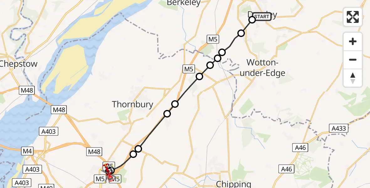
On Wednesday, 25 February 2026 at 18:10, a Air Ambulance Helicopter departed from Dursley to Almondsbury Helicopter Base. It was the Air Ambulance Helicopter with registration number G-GWAC. The flight lasted 8 minutes. During that period, the aircraft travelled 13 miles at an average speed of 96 miles per hour at a maximum altitude of 1100 feet.
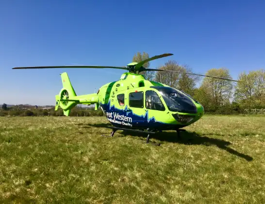
Helicopter: G-GWAC
The helicopter G-GWAC is used as a air ambulance helicopter. The main purpose of this aircraft is to transport a Mobile Medical Team to an incident as quickly as possible, enabling the trauma doctor to provide immediate first aid on site. The aircraft is flying this flight as Air Ambulance Helicopter.
Photo: Mojo0306
13 miles
1100 feet
96 mph
8 minutes
18:10
18:18

Route
Almondsbury Helicopter Base, Bristol, Somerset18:18
Almondsbury Helicopter Base, Bristol, Somerset18:18
Woodlands, West of England18:17
Hortham Lane, West of England18:17
Hortham, West of England18:16
Rudgeway, West of England18:16
Tytherington, West of England18:14
Milbury Heath, West of England18:14
Cromhall, West of England18:13
Tortworth, West of England18:13
Charfield, West of England18:12
Stroud18:12
North Nibley, Stroud18:11
Stinchcombe, Dursley18:11
Harrolds Close, 18:10
Live flights
Today
Flights Dursley
Air Ambulance Helicopter to Dursley, Cedar Drive11 Jul 17:42
Police Helicopter to Bristol, Bradley Stoke Way17 May 07:28
Police Helicopter to Almondsbury Helicopter Base17 May 01:39
Police Helicopter to Dursley16 May 18:43
Police Helicopter to Almondsbury Helicopter Base16 May 18:33
Helicopter flights on your website?
You can easily display helicopter flights on your own website. Use the embed code.
