Police Helicopter to Tonbridge, Shipbourne Road
Wednesday, 25 February 2026 | 15:54 | From South Nutfield
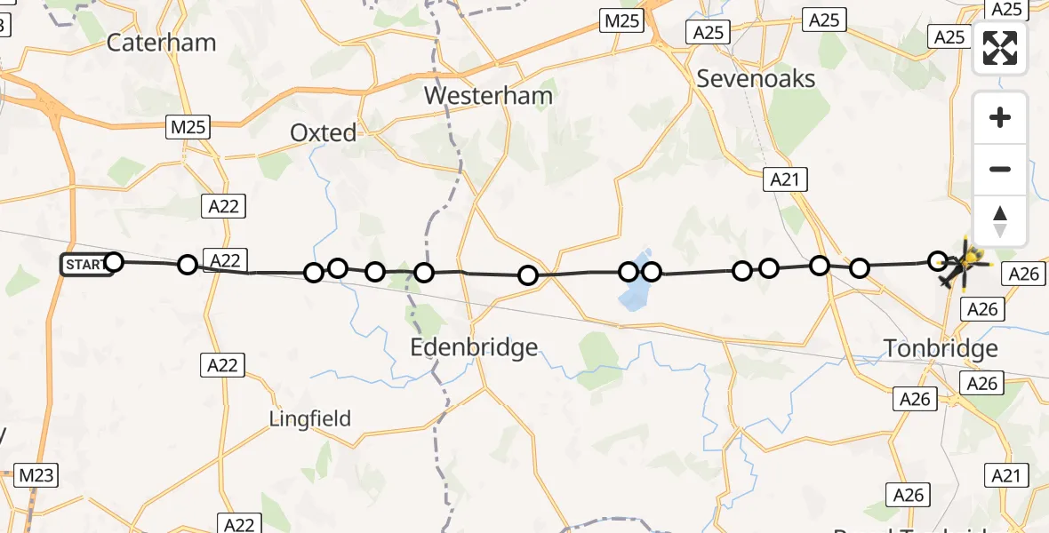
On Wednesday, 25 February 2026 at 15:54, a Police Helicopter departed from South Nutfield to Tonbridge. It was the Police Helicopter with registration number G-POLH. The flight lasted 7 minutes. During that period, the aircraft travelled 17 miles at an average speed of 142 miles per hour at a maximum altitude of 1200 feet.
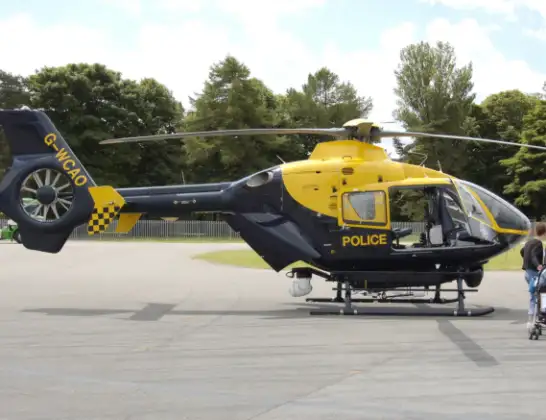
Helicopter: G-POLH
The helicopter G-POLH is used by the British police. The helicopter is deployed in pursuits, missing persons cases and other incidents where a helicopter provides added value.
Photo: Arpingstone
18 miles
1200 feet
142 mph
8 minutes
15:54
16:02

Route
Shipbourne Road, Tonbridge and Malling16:02
Tonbridge, Tonbridge and Malling16:01
Hildenborough, Tonbridge and Malling16:00
Tonbridge and Malling16:00
Sevenoaks16:00
Sevenoaks Weald, Sevenoaks15:59
Sevenoaks15:59
Bough Beech Reservoir15:59
Hever, Sevenoaks15:58
Edenbridge15:57
Merle Common15:57
Merle Common, Oxted15:56
Crowhurst15:56
South Godstone15:55
Tandridge15:54
Coopers Hill Road, 15:54
Live flights
Police Helicopter on its way from Dundrod12 Jul 22:50
Today
Police Helicopter to East Ardsley, Stoney Lane12 Jul 23:51
Police Helicopter to Birmingham Airport12 Jul 23:46
Police Helicopter to Parkham Ash12 Jul 23:41
Air Ambulance Helicopter to Newlands of Culloden12 Jul 23:24
Flights Tonbridge
Police Helicopter to Tonbridge, Shipbourne Road25 Feb 15:54
Police Helicopter to Tonbridge, Silver Close9 Feb 02:40
Police Helicopter to Tonbridge, Silver Close9 Feb 02:47
Police Helicopter to Tonbridge, Silver Close9 Feb 02:47
Police Helicopter to Tonbridge, Silver Close9 Feb 02:47
Helicopter flights on your website?
You can easily display helicopter flights on your own website. Use the embed code.
