Air Ambulance Aircraft to Borgh, Glasgow Airport
Tuesday, 24 February 2026 | 20:10 | From Glasgow Airport
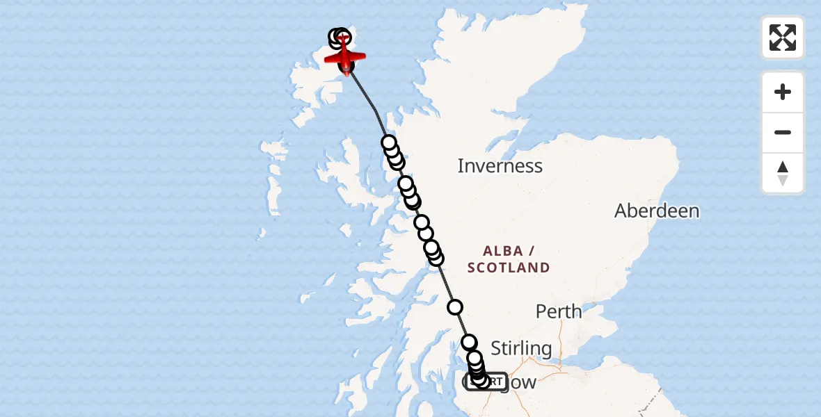
On Tuesday, 24 February 2026 at 20:10, a Air Ambulance Aircraft departed from Glasgow Airport to Borgh. It was the Air Ambulance Aircraft with registration number G-SASD. The flight lasted 51 minutes. During that period, the aircraft travelled 210 miles at an average speed of 248 miles per hour at a maximum altitude of 18025 feet.
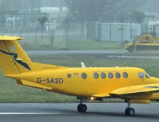
Helicopter: G-SASD
The aircraft G-SASD is used as an air ambulance aircraft. The main purpose of this aircraft is to transport a Mobile Medical Team to an incident as quickly as possible, enabling the trauma doctor to provide immediate first aid on site. The aircraft is flying this flight as Air Ambulance Aircraft.
Photo: Albert Bridge
210 miles
18025 feet
248 mph
51 minutes
20:10
21:00

Route
21:00
Borgh20:56
Gabhsann bho Thuath20:56
Borgh20:55
Siadar20:54
Col Uarach20:52
Àird Thunga20:51
Steinis20:51
Stornoway Airport, Stornoway, Western Isles20:51
Bràigh na h-Aoidhe20:51
Inner Seas20:41
Diabaig20:40
Inner Seas20:39
Shieldaig20:39
Ardnarff20:37
Allt-nan-Subh20:36
Invershiel20:35
Shiel Bridge20:35
Loch Cuaich20:32
Loch Arkaig20:31
Fort William20:30
Corpach20:29
Fort William20:28
Arrivain20:23
Loch Lomond20:18
Rowardennan20:18
Loch Lomond20:16
Balloch20:15
Bonhill20:15
Dumbarton20:14
Milton20:14
Bishopton20:13
Linwood20:12
Glasgow Airport, Glasgow20:11
Glasgow Airport, Glasgow20:10
Live flights
Today
Flights Borgh
Air Ambulance Aircraft to Borgh, Glasgow Airport28 Feb 15:02
Air Ambulance Aircraft to Borgh, Tàbost26 Feb 11:33
Air Ambulance Aircraft to Borgh, Glasgow Airport24 Feb 20:10
Air Ambulance Aircraft to Borgh21 Jan 23:42
Helicopter flights on your website?
You can easily display helicopter flights on your own website. Use the embed code.
