Air Ambulance Helicopter to Newcastle Royal Victoria Infirmary
Tuesday, 24 February 2026 | 16:10 | From Muggleswick
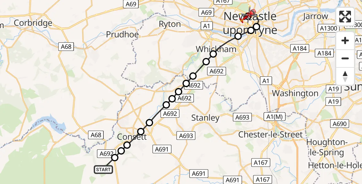
On Tuesday, 24 February 2026 at 16:10, a Air Ambulance Helicopter departed from Muggleswick to Newcastle Royal Victoria Infirmary. It was the Air Ambulance Helicopter with registration number G-NHAE. The flight lasted 9 minutes. During that period, the aircraft travelled 17 miles at an average speed of 121 miles per hour at a maximum altitude of 1725 feet.
Helicopter: G-NHAE
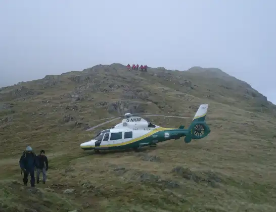
The helicopter G-NHAE is used as a air ambulance helicopter. The main purpose of this aircraft is to transport a Mobile Medical Team to an incident as quickly as possible, enabling the trauma doctor to provide immediate first aid on site. The aircraft is flying this flight as Air Ambulance Helicopter.
Photo: Michael Earnshaw
18 miles
1725 feet
121 mph
9 minutes
16:10
16:19

Route
Newcastle Royal Victoria Infirmary, Newcastle upon Tyne16:19
Newcastle Royal Victoria Infirmary, Newcastle upon Tyne16:17
Newcastle Royal Victoria Infirmary, Newcastle upon Tyne16:16
Newcastle upon Tyne, North East16:15
Gateshead, North East16:15
Newcastle upon Tyne, North East16:14
Whickham, North East16:14
Sunniside, Gateshead16:13
Whickham, North East16:13
Burnopfield, North East16:13
Hobson, North East16:12
Tantobie, North East16:12
Hamsterley Mill, North East16:12
Leadgate, North East16:11
Consett, North East16:11
Templetown, Consett16:11
Templetown, North East16:10
Consett, North East16:10
Muggleswick, North East16:10
Today
Flights Muggleswick
Helicopter flights on your website?
You can easily display helicopter flights on your own website. Use the embed code.
