Police Helicopter to MOD St Athan
Tuesday, 24 February 2026 | 12:28 | From Henllys
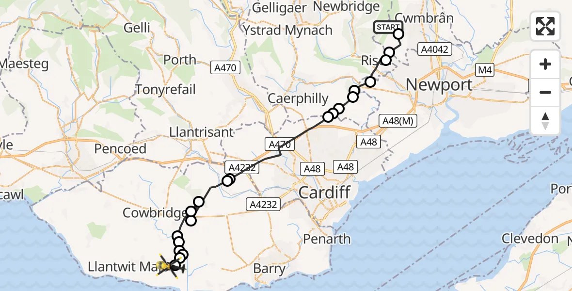
On Tuesday, 24 February 2026 at 12:28, a Police Helicopter departed from Henllys to MOD St Athan. It was the Police Helicopter with registration number G-NWOI. The flight lasted 12 minutes. During that period, the aircraft travelled 29 miles at an average speed of 147 miles per hour at a maximum altitude of 1300 feet.

Helicopter: G-NWOI
The helicopter G-NWOI is used by the British police. The helicopter is deployed in pursuits, missing persons cases and other incidents where a helicopter provides added value.
Photo: James from Cheltenham
29 miles
1300 feet
147 mph
12 minutes
12:28
12:40

Route
MOD St Athan, St Athan, Vale of Glamorgan12:40
MOD St Athan, St Athan, Vale of Glamorgan12:39
Flemingston12:39
St. Athan12:39
Flemingston12:39
Llanfair12:39
Llancarfan12:38
St Hilary12:38
Welsh St. Donats12:37
St Hilary12:37
Pendoylan12:36
Peterston-super-Ely12:36
Cardiff12:32
Rudry12:32
Cardiff12:32
Rudry12:31
Machen12:31
Newport12:30
Risca12:30
Henllys12:29
Cwmbrân12:29
Twrch Trail, 12:28
Live flights
Today
Flights Henllys
Police Helicopter to MOD St Athan24 Feb 12:28
Helicopter flights on your website?
You can easily display helicopter flights on your own website. Use the embed code.
