Police Helicopter to Gargrave, Skipton Road
Tuesday, 24 February 2026 | 4:59 | From East Ardsley
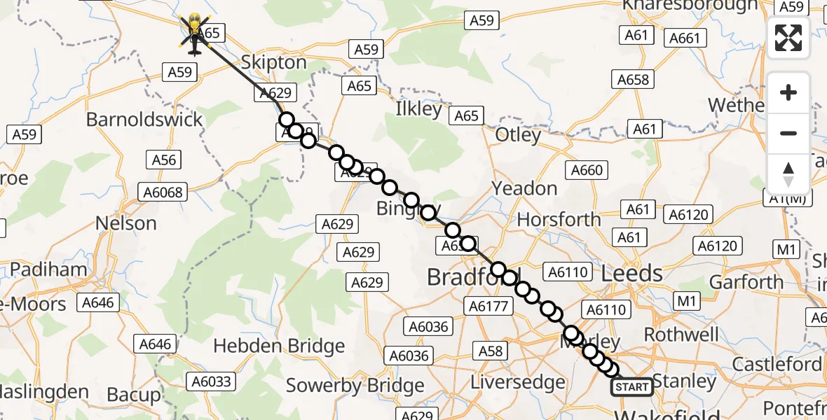
On Tuesday, 24 February 2026 at 4:59, a Police Helicopter departed from East Ardsley to Gargrave. It was the Police Helicopter with registration number G-POLB. The flight lasted 19 minutes. During that period, the aircraft travelled 31 miles at an average speed of 98 miles per hour at a maximum altitude of 2100 feet.
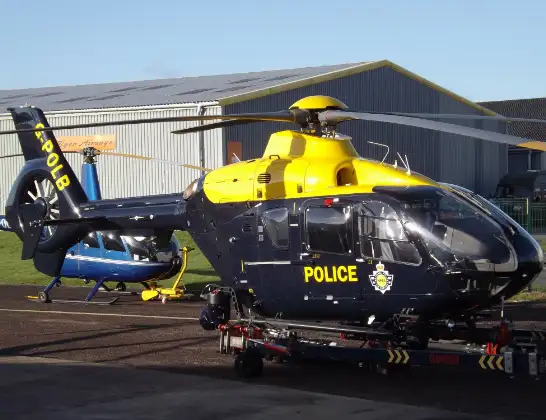
Helicopter: G-POLB
The helicopter G-POLB is used by the British police. The helicopter is deployed in pursuits, missing persons cases and other incidents where a helicopter provides added value.
Photo: James from Cheltenham, Gloucestershire
31 miles
2100 feet
98 mph
19 minutes
04:59
05:18

Route
Skipton Road, York and North Yorkshire05:18
Cononley, York and North Yorkshire05:11
Crosshills, York and North Yorkshire05:11
Eastburn, Bradford05:10
Steeton, Bradford05:09
Keighley, Bradford05:09
Steeton, Keighley05:09
Riddlesden, Keighley05:08
Sandbeds, Keighley05:07
Crossflatts, Bingley05:07
Bingley, Bradford05:06
Shipley, Bradford05:06
Wrose, Bradford05:05
Bradford, West Yorkshire05:04
Farsley, Leeds05:04
Pudsey, Leeds05:03
Fulneck Moravian Settlement, Leeds05:03
Tong, Bradford05:03
Drighlington, Bradford05:02
Gildersome, Leeds05:02
Churwell, Morley05:02
Morley, Leeds05:01
Woodkirk, Morley05:01
Tingley, Morley05:01
Tingley, Leeds05:00
Stoney Lane, Leeds04:59
Live flights
Police Helicopter on its way from Renfrew15 Jul 23:02
Today
Air Ambulance Helicopter to Dunkeswell Airfield15 Jul 23:01
Police Helicopter to Manchester Barton Aerodrome15 Jul 22:25
Police Helicopter to Baxterley Aerodrome15 Jul 22:24
Air Ambulance Helicopter to Henstridge Airfield15 Jul 22:14
Coastguard Helicopter to Argyll and Bute, B84515 Jul 22:05
Police Helicopter to MOD St Athan15 Jul 21:51
Flights Gargrave
Police Helicopter to Gargrave, Skipton Road24 Feb 04:59
Helicopter flights on your website?
You can easily display helicopter flights on your own website. Use the embed code.
