Air Ambulance Helicopter to Kinnersley, M5
Monday, 23 February 2026 | 12:55 | From Queen Elizabeth Hospital Helipad
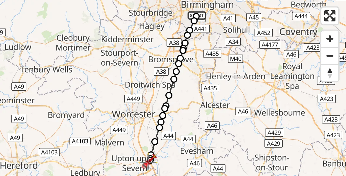
On Monday, 23 February 2026 at 12:55, a Air Ambulance Helicopter departed from Queen Elizabeth Hospital Helipad to Kinnersley. It was the Air Ambulance Helicopter with registration number G-OMAA. The flight lasted 14 minutes. During that period, the aircraft travelled 31 miles at an average speed of 128 miles per hour at a maximum altitude of 1425 feet.
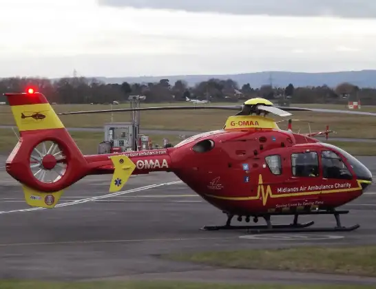
Helicopter: G-OMAA
The helicopter G-OMAA is used as a air ambulance helicopter. The main purpose of this aircraft is to transport a Mobile Medical Team to an incident as quickly as possible, enabling the trauma doctor to provide immediate first aid on site. The aircraft is flying this flight as Air Ambulance Helicopter.
Photo: James from Cheltenham, Gloucestershire
31 miles
1425 feet
128 mph
15 minutes
12:55
13:09

Route
M5, Wychavon13:09
Upper Strensham, Wychavon13:09
Wychavon13:09
Defford, Wychavon13:09
Wychavon13:07
Drakes Broughton, Wychavon13:06
Wychavon13:06
Upton Snodsbury, Wychavon13:05
Crowle, Wychavon13:04
Wychavon13:04
Himbleton, Wychavon13:03
Hanbury, Wychavon13:02
Stoke Pound, Bromsgrove13:01
Finstall CP, Bromsgrove13:00
Tutnall, Bromsgrove13:00
Blackwell, Bromsgrove12:59
Bromsgrove12:59
Cofton Hackett CP, Bromsgrove12:58
Rednal, Birmingham12:57
Turves Green, Birmingham12:57
Birmingham, West Midlands12:56
Metchley, Birmingham12:55
Griffin Gardens, Birmingham12:55
Today
Police Helicopter to Epping Forest, Green Lane26 Feb 23:43
Flights Kinnersley
Air Ambulance Helicopter to Kinnersley, M523 Feb 18:47
Air Ambulance Helicopter to Kinnersley, M523 Feb 12:55
Air Ambulance Helicopter to Kinnersley, M530 Jan 14:05
Air Ambulance Helicopter to Kinnersley, M524 Jan 15:42
Air Ambulance Helicopter to Kinnersley, M521 Jan 15:14
Helicopter flights on your website?
You can easily display helicopter flights on your own website. Use the embed code.
