Air Ambulance Helicopter to Kinnersley, M5
Friday, 30 January 2026 | 14:05 | From Gloucester Royal Hospital
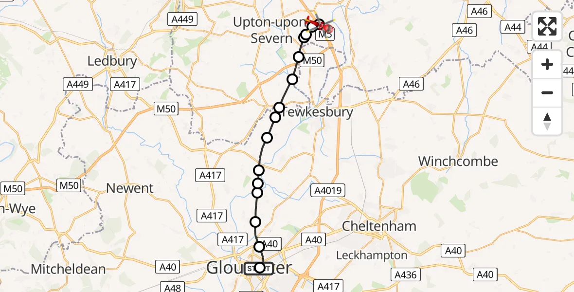
On Friday, 30 January 2026 at 14:05, a Air Ambulance Helicopter departed from Gloucester Royal Hospital to Kinnersley. It was the Air Ambulance Helicopter with registration number G-OMAA. The flight lasted 8 minutes. During that period, the aircraft travelled 16 miles at an average speed of 127 miles per hour at a maximum altitude of 1925 feet.
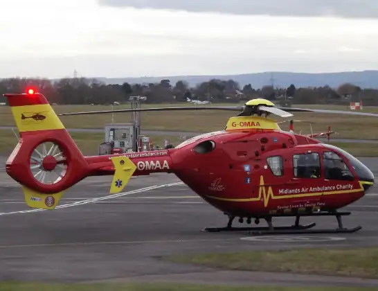
Helicopter: G-OMAA
The helicopter G-OMAA is used as a air ambulance helicopter. The main purpose of this aircraft is to transport a Mobile Medical Team to an incident as quickly as possible, enabling the trauma doctor to provide immediate first aid on site. The aircraft is flying this flight as Air Ambulance Helicopter.
Photo: James from Cheltenham, Gloucestershire
16 miles
1925 feet
127 mph
8 minutes
14:05
14:12

Route
M5, Wychavon14:12
Hill Croome, Malvern Hills14:12
Upper Strensham, Wychavon14:12
Hill Croome, Malvern Hills14:11
Upper Strensham, Wychavon14:11
Ripple, Tewkesbury14:11
Ripple, Malvern Hills14:10
Bushley, Malvern Hills14:09
Forthampton, Tewkesbury14:09
Chaceley, Tewkesbury14:09
Tirley, Tewkesbury14:08
Hasfield, Tewkesbury14:08
Norton, Tewkesbury14:07
Twigworth, Tewkesbury14:07
Longford, Tewkesbury14:06
Horton Road, 14:05
Gloucester14:05
Gloucester Royal Hospital, Gloucester14:05
Today
Flights Kinnersley
Air Ambulance Helicopter to Tewkesbury, A386 May 16:31
Air Ambulance Helicopter to Upper Rissington26 Apr 12:57
Air Ambulance Helicopter to Kinnersley11 Apr 11:54
Air Ambulance Helicopter to Kinnersley, M53 Apr 15:40
Air Ambulance Helicopter to Kinnersley, M52 Apr 12:50
Air Ambulance Helicopter to Kinnersley, M525 Mar 10:43
Air Ambulance Helicopter to Kinnersley, M523 Feb 18:47
Air Ambulance Helicopter to Kinnersley, M523 Feb 12:55
Helicopter flights on your website?
You can easily display helicopter flights on your own website. Use the embed code.
