Air Ambulance Helicopter to Wychavon, Netherton Lane
Monday, 23 February 2026 | 8:22 | From Upper Strensham
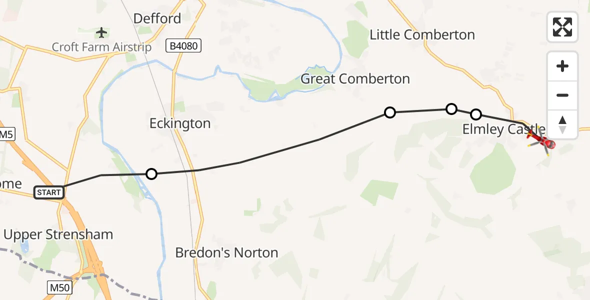
On Monday, 23 February 2026 at 8:22, a Air Ambulance Helicopter departed from Upper Strensham to Wychavon. It was the Air Ambulance Helicopter with registration number G-OMAA. The flight lasted 2 minutes. During that period, the aircraft travelled 6 miles at an average speed of 146 miles per hour at a maximum altitude of 900 feet.
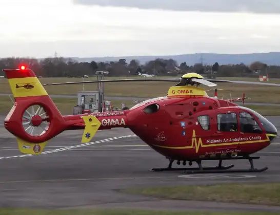
Helicopter: G-OMAA
The helicopter G-OMAA is used as a air ambulance helicopter. The main purpose of this aircraft is to transport a Mobile Medical Team to an incident as quickly as possible, enabling the trauma doctor to provide immediate first aid on site. The aircraft is flying this flight as Air Ambulance Helicopter.
Photo: James from Cheltenham, Gloucestershire
6 miles
900 feet
146 mph
3 minutes
08:22
08:25

Route
Netherton Lane, 08:25
Elmley Castle, Wychavon08:24
Little Comberton, Wychavon08:24
Great Comberton, Wychavon08:24
Eckington, Wychavon08:23
M5, Wychavon08:22
Live flights
Today
Flights Wychavon
Air Ambulance Helicopter to Wychavon, A410428 May 10:11
Air Ambulance Helicopter to Wychavon, A410428 May 10:04
Air Ambulance Helicopter to Upper Strensham, M521 Apr 12:43
Air Ambulance Helicopter to Hill Croome, M518 Mar 18:54
Helicopter flights on your website?
You can easily display helicopter flights on your own website. Use the embed code.
