Coastguard Helicopter to Penparcau
Sunday, 22 February 2026 | 10:34 | From Clarach
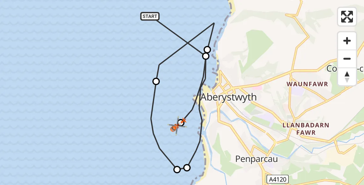
On Sunday, 22 February 2026 at 10:34, a Coastguard Helicopter departed from Clarach to Penparcau. It was the Coastguard Helicopter with registration number G-MCGZ. The flight lasted 8 minutes. During that period, the aircraft travelled 7 miles at an average speed of 54 miles per hour at a maximum altitude of 425 feet.
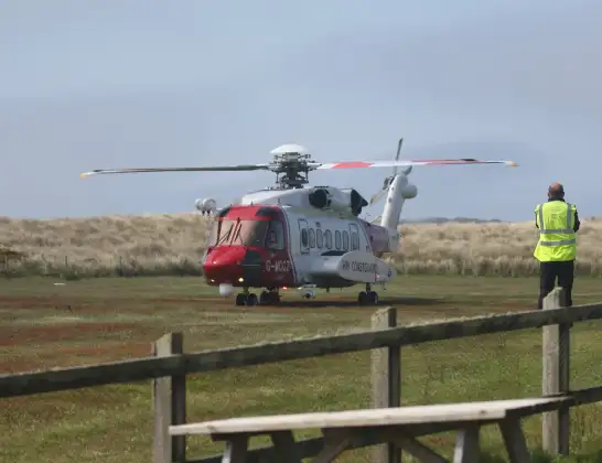
Helicopter: G-MCGZ
The helicopter G-MCGZ is used by the British Coastguard. The helicopter is deployed in search and rescue operations at sea, rescue operations involving ships or drilling platforms, patrols to prevent smuggling or piracy, environmental monitoring and disaster relief support.
Photo: Andrewrabbott
8 miles
425 feet
54 mph
8 minutes
10:34
10:42

Route
Penparcau, 10:42
Penparcau10:42
Aberystwyth10:40
Clarach10:38
Penparcau10:37
Rhydyfelin10:37
Aberystwyth10:35
Clarach, 10:34
Live flights
Today
Air Ambulance Helicopter to Southampton Airport23 Jun 23:52
Coastguard Helicopter to Inverness Airport23 Jun 23:35
Air Ambulance Helicopter to Cardiff Heliport23 Jun 22:58
Police Helicopter to North Weald Airfield23 Jun 22:39
Air Ambulance Helicopter to Farnborough Airport23 Jun 22:35
Coastguard Helicopter to Humberside Airport23 Jun 22:32
Air Ambulance Helicopter to Norwich Airport23 Jun 22:16
Flights Penparcau
Air Ambulance Helicopter to Cardiff Heliport29 May 21:38
Air Ambulance Helicopter to Cardiff Heliport27 May 19:23
Air Ambulance Helicopter to Penparcau, Gwel Afon27 May 18:38
Air Ambulance Helicopter to Dafen, Heol Aur17 Apr 17:28
Coastguard Helicopter to Penparcau22 Feb 10:34
Flights Clarach
Coastguard Helicopter to Penparcau22 Feb 10:34
Coastguard Helicopter to Clarach22 Feb 09:14
Helicopter flights on your website?
You can easily display helicopter flights on your own website. Use the embed code.
