Air Ambulance Helicopter to Hill Croome, M5
Saturday, 21 February 2026 | 13:22 | From Staverton
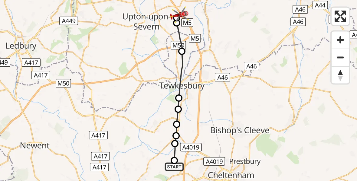
On Saturday, 21 February 2026 at 13:22, a Air Ambulance Helicopter departed from Staverton to Hill Croome. It was the Air Ambulance Helicopter with registration number G-OMAA. The flight lasted 5 minutes. During that period, the aircraft travelled 11 miles at an average speed of 147 miles per hour at a maximum altitude of 900 feet.
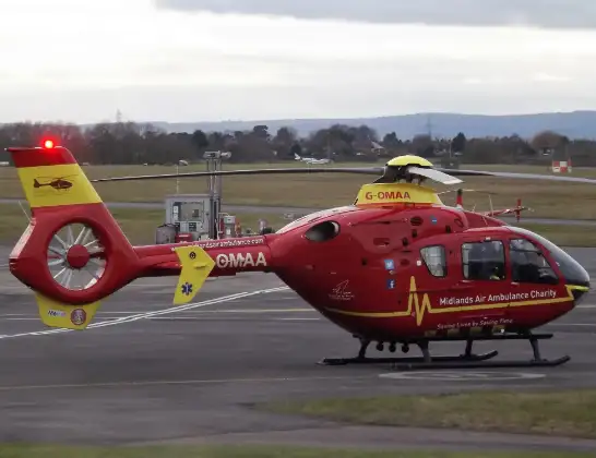
Helicopter: G-OMAA
The helicopter G-OMAA is used as a air ambulance helicopter. The main purpose of this aircraft is to transport a Mobile Medical Team to an incident as quickly as possible, enabling the trauma doctor to provide immediate first aid on site. The aircraft is flying this flight as Air Ambulance Helicopter.
Photo: James from Cheltenham, Gloucestershire
12 miles
900 feet
147 mph
5 minutes
13:22
13:26

Route
M5, Malvern Hills13:26
Hill Croome, Malvern Hills13:26
Upper Strensham, Worcester13:26
Twyning, Tewkesbury13:25
Tewkesbury13:24
Tredington, Tewkesbury13:23
Deerhurst, Tewkesbury13:23
Tewkesbury13:23
Leigh, Tewkesbury13:23
Tewkesbury13:22
Brock Farm Lane, Tewkesbury13:22
Live flights
Police Helicopter on its way from RAF Benson12 Jul 22:54
Police Helicopter on its way from Dundrod12 Jul 22:50
Today
Police Helicopter to East Ardsley, Stoney Lane12 Jul 23:51
Police Helicopter to Birmingham Airport12 Jul 23:46
Air Ambulance Helicopter to Glasgow Airport12 Jul 22:48
Police Helicopter to Walton Wood Airfield12 Jul 22:44
Flights Staverton
Police Helicopter to Staverton30 Mar 20:19
Police Helicopter to Staverton, Bamfurlong Lane23 Feb 10:04
Air Ambulance Helicopter to Hill Croome, M521 Feb 13:22
Air Ambulance Helicopter to Staverton, M510 Feb 13:05
Helicopter flights on your website?
You can easily display helicopter flights on your own website. Use the embed code.
