Police Helicopter to Steeton, Aire Valley Bypass
Saturday, 21 February 2026 | 9:05 | From East Ardsley
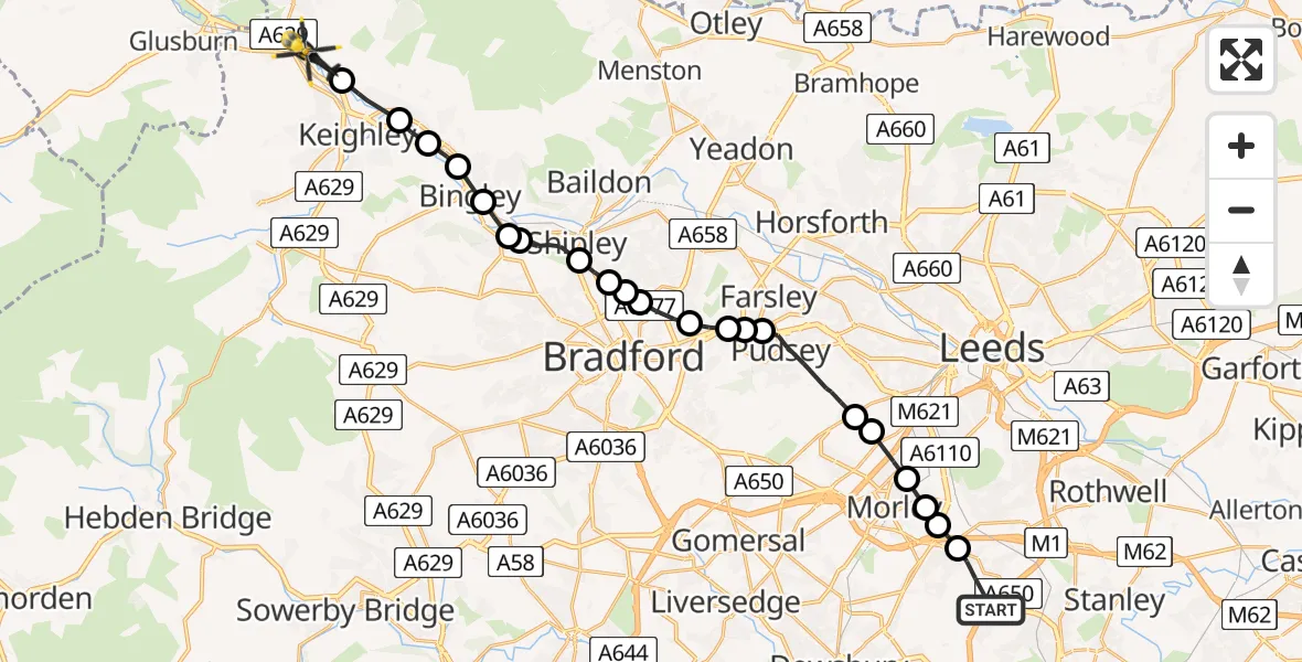
On Saturday, 21 February 2026 at 9:05, a Police Helicopter departed from East Ardsley to Steeton. It was the Police Helicopter with registration number G-POLB. The flight lasted 12 minutes. During that period, the aircraft travelled 21 miles at an average speed of 105 miles per hour at a maximum altitude of 1700 feet.
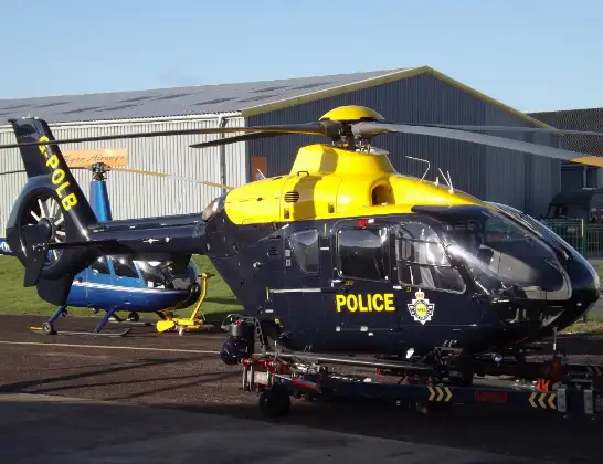
Helicopter: G-POLB
The helicopter G-POLB is used by the British police. The helicopter is deployed in pursuits, missing persons cases and other incidents where a helicopter provides added value.
Photo: James from Cheltenham, Gloucestershire
22 miles
1700 feet
105 mph
13 minutes
09:05
09:17

Route
Aire Valley Bypass, Bradford09:17
Silsden, Bradford09:17
Riddlesden, Keighley09:16
Sandbeds, Keighley09:15
Crossflatts, Bingley09:15
Bingley, Bradford09:14
Cottingley, Bingley09:14
Cottingley, Shipley09:14
Shipley, Bradford09:13
Wrose, Bradford09:12
Bradford, West Yorkshire09:12
Wrose, Bradford09:12
Bradford, West Yorkshire09:11
Farsley, Leeds09:10
Pudsey, Leeds09:10
Farsley, Leeds09:10
Pudsey, Leeds09:08
Gildersome, Leeds09:08
Churwell, Morley09:07
Morley, Leeds09:07
Tingley, Morley09:06
Tingley, Leeds09:06
Stoney Lane, Leeds09:05
Live flights
Today
Flights Steeton
Police Helicopter to East Ardsley, Stoney Lane21 Jun 18:33
Police Helicopter to Steeton, Aire Valley Bypass21 Jun 17:58
Police Helicopter to Steeton, Aire Valley Bypass21 Feb 09:05
Police Helicopter to Steeton, Acton Court15 Feb 21:28
Police Helicopter to Steeton, Market Street15 Feb 21:20
Police Helicopter to Steeton, Barrows Lane15 Feb 20:58
Helicopter flights on your website?
You can easily display helicopter flights on your own website. Use the embed code.
