Coastguard Helicopter to Syre
Saturday, 21 February 2026 | 1:05 | From Crask
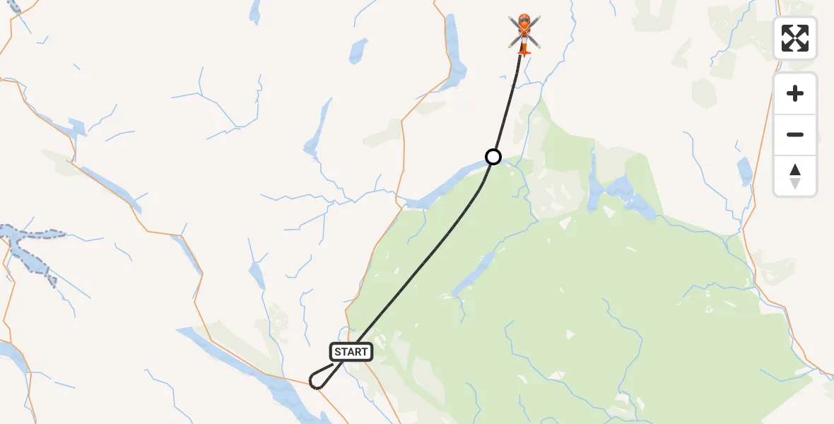
On Saturday, 21 February 2026 at 1:05, a Coastguard Helicopter departed from Crask to Syre. It was the Coastguard Helicopter with registration number G-MCGT. The flight lasted 15 minutes. During that period, the aircraft travelled 24 miles at an average speed of 100 miles per hour at a maximum altitude of 4525 feet.
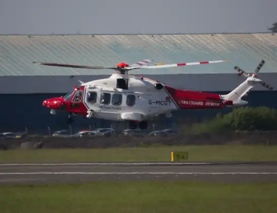
Helicopter: G-MCGT
The helicopter G-MCGT is used by the British Coastguard. The helicopter is deployed in search and rescue operations at sea, rescue operations involving ships or drilling platforms, patrols to prevent smuggling or piracy, environmental monitoring and disaster relief support.
Photo: Ronnie Macdonald
25 miles
4525 feet
100 mph
15 minutes
01:05
01:20

Route
01:20
Syre01:15
Crask01:09
01:05
Live flights
Today
Flights Syre
Coastguard Helicopter to Syre21 Feb 01:05
Flights Crask
Coastguard Helicopter to Stornoway Airport21 Feb 09:14
Coastguard Helicopter to Crask, Inner Seas21 Feb 07:33
Coastguard Helicopter to Syre21 Feb 01:05
Coastguard Helicopter to Inverness Airport20 Feb 20:36
Coastguard Helicopter to Crask20 Feb 19:20
Helicopter flights on your website?
You can easily display helicopter flights on your own website. Use the embed code.
