Air Ambulance Helicopter to Wigston, Freshwater Close
Friday, 20 February 2026 | 16:02 | From Coventry
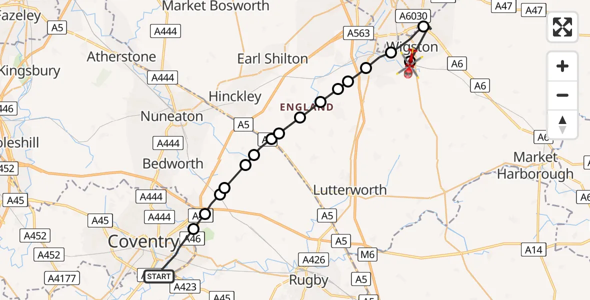
On Friday, 20 February 2026 at 16:02, a Air Ambulance Helicopter departed from Coventry to Wigston. It was the Air Ambulance Helicopter with registration number G-WNAS. The flight lasted 10 minutes. During that period, the aircraft travelled 27 miles at an average speed of 157 miles per hour at a maximum altitude of 1475 feet.
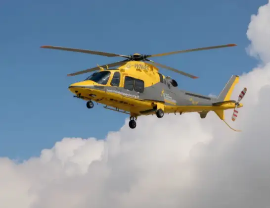
Helicopter: G-WNAS
The helicopter G-WNAS is used as an ambulance helicopter. The helicopter is equipped with a stretcher for transporting patients. The helicopter is often used to transport to hospitals.
Photo: Tony Melony
28 miles
1475 feet
157 mph
11 minutes
16:02
16:13

Route
Freshwater Close, Oadby and Wigston16:13
Wigston, Oadby and Wigston16:12
Oadby, Oadby and Wigston16:10
Wigston, Oadby and Wigston16:09
Whetstone16:08
Cosby16:08
Harborough16:08
Broughton Astley, Harborough16:07
Frolesworth16:07
Sharnford16:06
Blaby16:06
Rugby16:06
Wolvey CP, Rugby16:05
Withybrook CP, Rugby16:05
Shilton, Rugby16:05
Ansty CP, Rugby16:04
University Hospital Coventry, Coventry16:04
Stonebridge Highway, West Midlands16:02
Today
Police Helicopter to Epping Forest, Green Lane26 Feb 23:43
Flights Wigston
Flights Coventry
Helicopter flights on your website?
You can easily display helicopter flights on your own website. Use the embed code.
