Air Ambulance Helicopter to Rothwell, A14
Friday, 20 February 2026 | 12:30 | From Coventry Airport
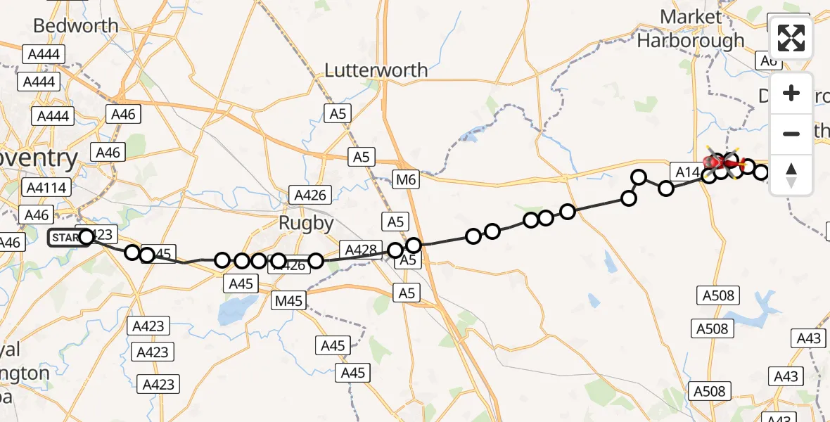
On Friday, 20 February 2026 at 12:30, a Air Ambulance Helicopter departed from Coventry Airport to Rothwell. It was the Air Ambulance Helicopter with registration number G-WNAS. The flight lasted 12 minutes. During that period, the aircraft travelled 30 miles at an average speed of 153 miles per hour at a maximum altitude of 1400 feet.
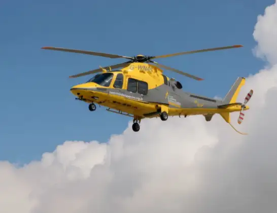
Helicopter: G-WNAS
The helicopter G-WNAS is used as an ambulance helicopter. The helicopter is equipped with a stretcher for transporting patients. The helicopter is often used to transport to hospitals.
Photo: Tony Melony
30 miles
1400 feet
153 mph
12 minutes
12:30
12:42

Route
A14, 12:42
Rothwell12:41
Kelmarsh12:41
Rothwell12:40
Harrington12:39
Rothwell12:39
Draughton12:39
Rothwell12:38
Haselbech12:38
Naseby12:38
Northampton12:37
Thornby12:37
Cold Ashby12:36
Northampton12:36
Winwick12:36
Yelvertoft12:35
Crick12:35
Clifton upon Dunsmore CP, Rugby12:34
Rugby12:33
Bilton, Rugby12:33
Dunchurch, Rugby12:33
Bilton, Rugby12:32
Long Lawford, Rugby12:32
Stretton on Dunsmore CP, Rugby12:31
Rugby12:31
Ryton-on-Dunsmore, Rugby12:30
Siskin Parkway East, Warwick12:30
Live flights
Today
Police Helicopter to Benson, Clack's Lane30 May 23:59
Air Ambulance Helicopter to Southampton Airport30 May 23:23
Coastguard Helicopter to English Channel30 May 23:12
Police Helicopter to South Nutfield, M2330 May 22:51
Police Helicopter to Manchester Barton Aerodrome30 May 22:31
Coastguard Helicopter to Manston Airport30 May 22:23
Police Helicopter to MOD St Athan30 May 22:09
Flights Rothwell
Air Ambulance Helicopter to Coventry Airport20 Feb 13:15
Air Ambulance Helicopter to Rothwell, A1420 Feb 12:30
Helicopter flights on your website?
You can easily display helicopter flights on your own website. Use the embed code.
