Coastguard Helicopter to Liverpool, Lower Lane
Thursday, 19 February 2026 | 18:12 | From Braichmelyn
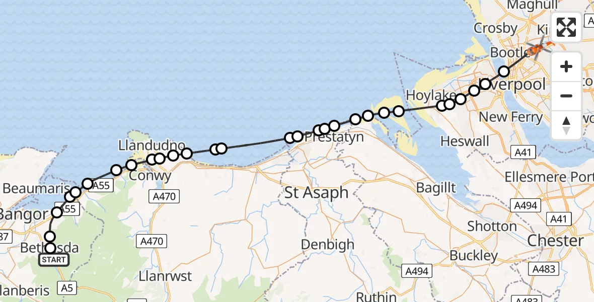
On Thursday, 19 February 2026 at 18:12, a Coastguard Helicopter departed from Braichmelyn to Liverpool. It was the Coastguard Helicopter with registration number G-MCGZ. The flight lasted 22 minutes. During that period, the aircraft travelled 56 miles at an average speed of 154 miles per hour at a maximum altitude of 1175 feet.
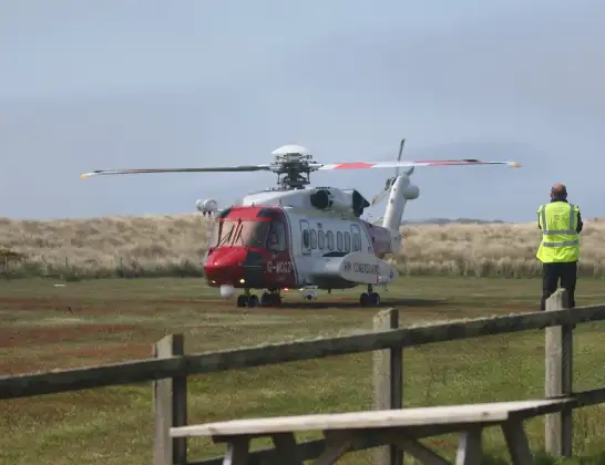
Helicopter: G-MCGZ
The helicopter G-MCGZ is used by the British Coastguard. The helicopter is deployed in search and rescue operations at sea, rescue operations involving ships or drilling platforms, patrols to prevent smuggling or piracy, environmental monitoring and disaster relief support.
Photo: Andrewrabbott
57 miles
1175 feet
154 mph
22 minutes
18:12
18:34

Route
Lower Lane, Liverpool City Region18:34
Liverpool, Liverpool City Region18:31
Wallasey, Wirral18:30
Prenton, Wirral18:29
Upton, Wirral18:29
Greasby, Wirral18:28
Hoylake, Wirral18:28
West Kirby, Wirral18:27
Ffynnongroyw18:26
Talacre18:26
Gwespyr18:25
Prestatyn18:24
Meliden18:24
St Asaph18:24
Rhyl18:23
Kinmel Bay18:23
Irish Sea18:20
Llysfaen18:20
Colwyn Bay18:19
Mochdre, Llandudno Junction18:19
Bryn Pydew, Llandudno Junction18:18
Llanrhos, Conwy18:18
Penmaenmawr18:17
Dwygyfylchi18:16
Penmaenmawr18:15
Llanfairfechan18:15
Aber18:15
Abergwyngregyn18:14
Llanllechid18:13
Bethesda18:12
Lon Las Ogwen, 18:12
Live flights
Police Helicopter on its way from RAF Benson12 Jul 22:54
Police Helicopter on its way from Dundrod12 Jul 22:50
Police Helicopter on its way from East Ardsley12 Jul 22:44
Today
Air Ambulance Helicopter to Glasgow Airport12 Jul 22:48
Air Ambulance Helicopter to Norwich Airport12 Jul 22:27
Air Ambulance Helicopter to Northrepps Aerodrome12 Jul 22:23
Police Helicopter to Harborough, Sulby Road12 Jul 22:20
Air Ambulance Helicopter to Derriford Hospital12 Jul 22:12
Police Helicopter to Manchester Barton Aerodrome12 Jul 22:11
Air Ambulance Helicopter to Northrepps Aerodrome12 Jul 22:03
Flights Liverpool
Air Ambulance Helicopter to Liverpool2 Apr 12:30
Coastguard Helicopter to Caernarfon Airport29 Mar 03:25
Coastguard Helicopter to Liverpool29 Mar 02:55
Coastguard Helicopter to Liverpool29 Mar 00:46
Flights Braichmelyn
Coastguard Helicopter to Caernarfon Airport9 May 10:05
Coastguard Helicopter to Caernarfon Airport19 Feb 23:34
Coastguard Helicopter to Liverpool, Lower Lane19 Feb 18:12
Helicopter flights on your website?
You can easily display helicopter flights on your own website. Use the embed code.
