Police Helicopter to MOD St Athan
Thursday, 19 February 2026 | 13:26 | From Bleadon
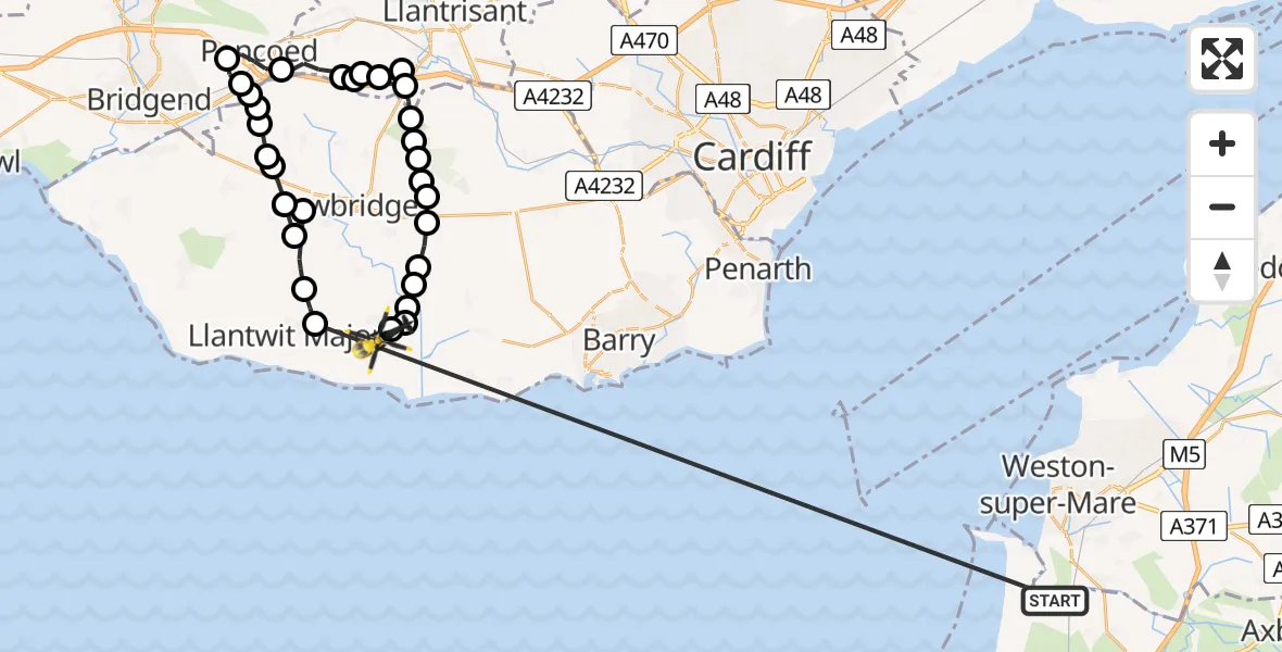
On Thursday, 19 February 2026 at 13:26, a Police Helicopter departed from Bleadon to MOD St Athan. It was the Police Helicopter with registration number G-NWOI. The flight lasted 15 minutes. During that period, the aircraft travelled 48 miles at an average speed of 193 miles per hour at a maximum altitude of 2200 feet.

Helicopter: G-NWOI
The helicopter G-NWOI is used by the British police. The helicopter is deployed in pursuits, missing persons cases and other incidents where a helicopter provides added value.
Photo: James from Cheltenham
48 miles
2200 feet
193 mph
15 minutes
13:26
13:41

Route
MOD St Athan, St Athan, Vale of Glamorgan13:41
MOD St Athan, St Athan, Vale of Glamorgan13:41
Flemingston13:41
St. Athan13:41
Flemingston13:40
Bonvilston13:40
St Hilary13:40
Welsh St. Donats13:39
Aberthin13:39
Welsh St. Donats13:39
Ystradowen13:39
Welsh St. Donats13:38
Brynsadler13:38
Llanharry13:37
Brynsadler13:35
Llanharry13:34
Pontyclun13:34
Llanharry13:33
Llanilid13:32
Pencoed13:31
Coychurch13:30
Treoes13:30
Llangan13:30
Treoes13:30
Llangan13:29
Penllyn13:29
Llysworney13:28
Sigingstone13:28
Llysworney13:28
Sigingstone13:27
Llanmaes13:26
Bleadon, 13:26
Live flights
Today
Flights Bleadon
Police Helicopter to MOD St Athan1 May 20:37
Police Helicopter to MOD St Athan25 Mar 17:45
Police Helicopter to MOD St Athan19 Feb 13:26
Police Helicopter to Ystalyfera, Ffordd Cwm Tawe19 Feb 10:12
Helicopter flights on your website?
You can easily display helicopter flights on your own website. Use the embed code.
