Air Ambulance Helicopter to Derby, Harriet Street
Wednesday, 18 February 2026 | 16:06 | From City of Nottingham
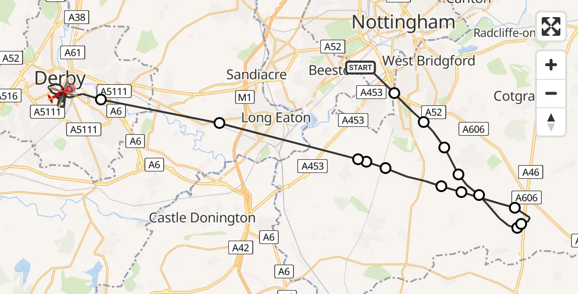
On Wednesday, 18 February 2026 at 16:06, a Air Ambulance Helicopter departed from City of Nottingham to Derby. It was the Air Ambulance Helicopter with registration number G-DRLA. The flight lasted 20 minutes. During that period, the aircraft travelled 33 miles at an average speed of 99 miles per hour at a maximum altitude of 1525 feet.
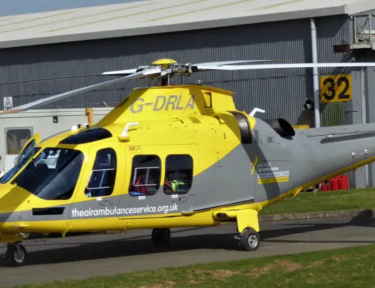
Helicopter: G-DRLA
The helicopter G-DRLA is used as an ambulance helicopter. The helicopter is equipped with a stretcher for transporting patients. The helicopter is often used to transport to hospitals.
Photo: Alec Wilson
34 miles
1525 feet
99 mph
21 minutes
16:06
16:26

Route
Harriet Street, East Midlands16:26
Derby, East Midlands16:22
Breaston, Derby16:20
Gotham, City of Nottingham16:19
Gotham, Rushcliffe16:19
Ruddington, Rushcliffe16:18
Bunny, Rushcliffe16:18
Keyworth, Rushcliffe16:17
Widmerpool, Rushcliffe16:17
Nottingham Heliport16:10
Willoughby on the Wolds, Rushcliffe16:10
Widmerpool, Rushcliffe16:09
Keyworth, Rushcliffe16:08
Bradmore, Rushcliffe16:08
Ruddington, Rushcliffe16:07
Ruddington, West Bridgford16:06
B Road, East Midlands16:06
Live flights
Today
Flights Derby
Air Ambulance Helicopter to Nottingham Heliport17 Mar 16:12
Air Ambulance Helicopter to Derby, Olive Street20 Feb 15:32
Air Ambulance Helicopter to Nottingham Heliport20 Feb 15:02
Air Ambulance Helicopter to Derby, Vernongate20 Feb 14:21
Helicopter flights on your website?
You can easily display helicopter flights on your own website. Use the embed code.
