Air Ambulance Helicopter to City of Nottingham, University Boulevard
Wednesday, 18 February 2026 | 15:03 | From Wymeswold
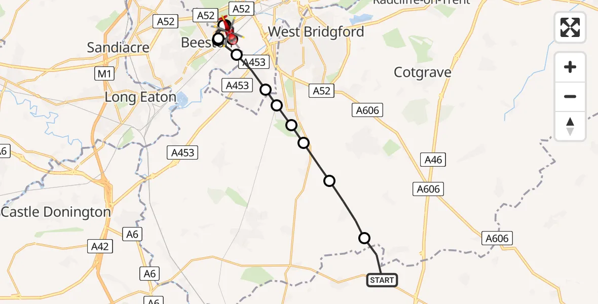
On Wednesday, 18 February 2026 at 15:03, a Air Ambulance Helicopter departed from Wymeswold to City of Nottingham. It was the Air Ambulance Helicopter with registration number G-DRLA. The flight lasted 6 minutes. During that period, the aircraft travelled 13 miles at an average speed of 134 miles per hour at a maximum altitude of 1450 feet.
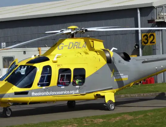
Helicopter: G-DRLA
The helicopter G-DRLA is used as an ambulance helicopter. The helicopter is equipped with a stretcher for transporting patients. The helicopter is often used to transport to hospitals.
Photo: Alec Wilson
13 miles
1450 feet
134 mph
6 minutes
15:03
15:09

Route
University Boulevard, East Midlands15:09
City of Nottingham, East Midlands15:08
Beeston, City of Nottingham15:08
Beeston, Broxtowe15:07
City of Nottingham, East Midlands15:07
Beeston, City of Nottingham15:06
Beeston, Broxtowe15:06
City of Nottingham, East Midlands15:06
Ruddington, Rushcliffe15:05
Ruddington, City of Nottingham15:05
Bradmore, Rushcliffe15:05
Bunny, Rushcliffe15:04
Wysall, Rushcliffe15:04
Wide Lane, Charnwood15:03
Live flights
Police Helicopter on its way from Dundrod12 Jul 22:50
Today
Police Helicopter to East Ardsley, Stoney Lane12 Jul 23:51
Police Helicopter to Birmingham Airport12 Jul 23:46
Police Helicopter to Parkham Ash12 Jul 23:41
Air Ambulance Helicopter to Newlands of Culloden12 Jul 23:24
Flights Wymeswold
Air Ambulance Helicopter to Coalville29 May 11:54
Air Ambulance Helicopter to Wymeswold, Wide Lane18 Feb 14:25
Helicopter flights on your website?
You can easily display helicopter flights on your own website. Use the embed code.
